


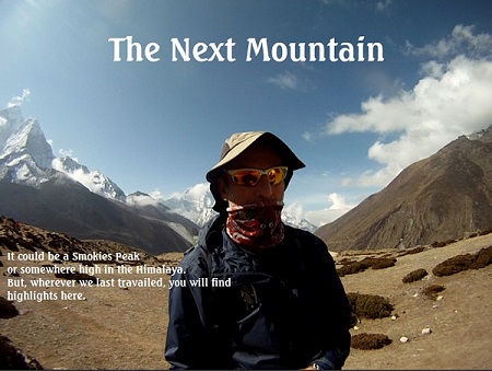
Cumberland Gap
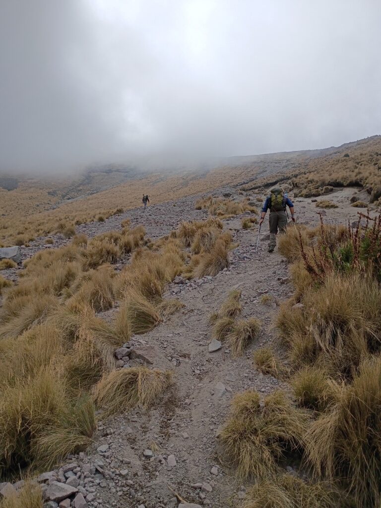
John Dempsey and I made the familiar trek up the Chadwell Gap trail. Rising 2100 ft in 3 1/2 mi, it is a steep little ascent. When I left on Friday the temperature was in the high 60s. That would change.
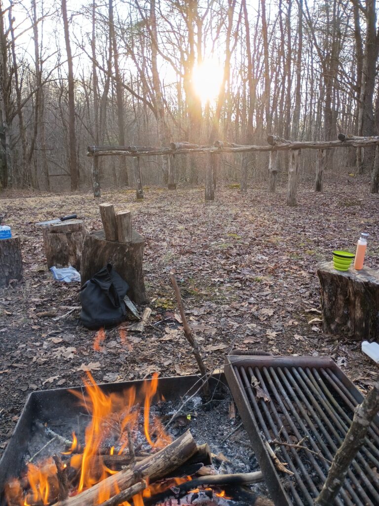
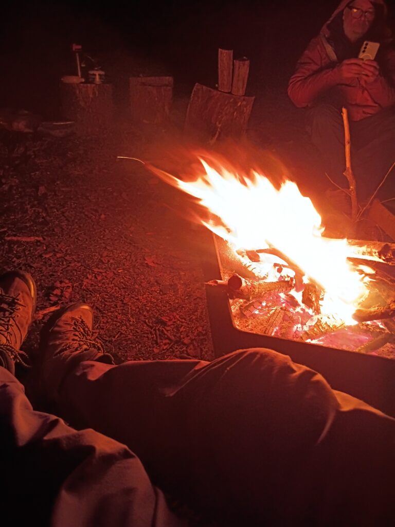
John had a nice fire waiting when I arrived around sunset. Wood was plentiful and the views were amazing.
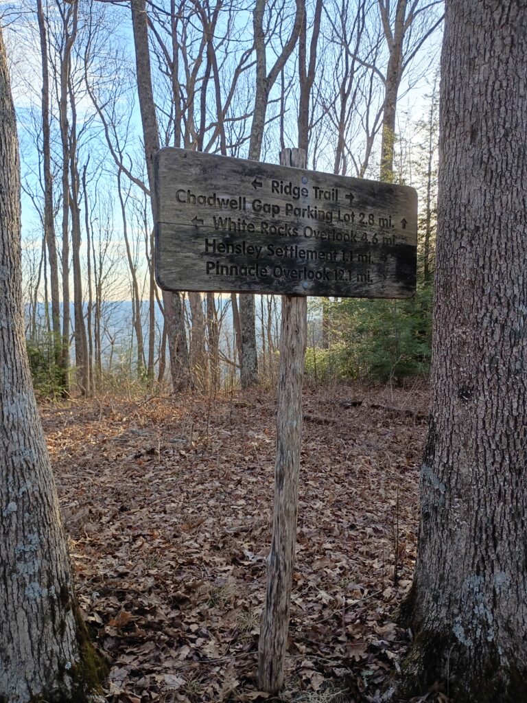
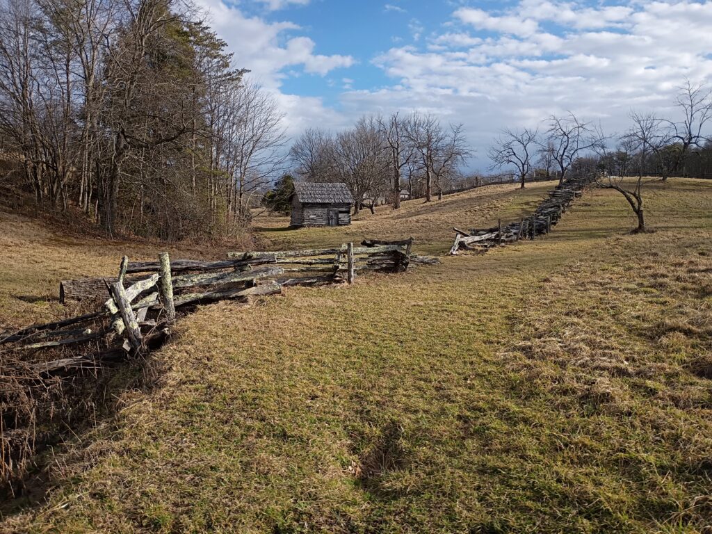
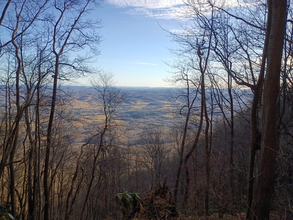
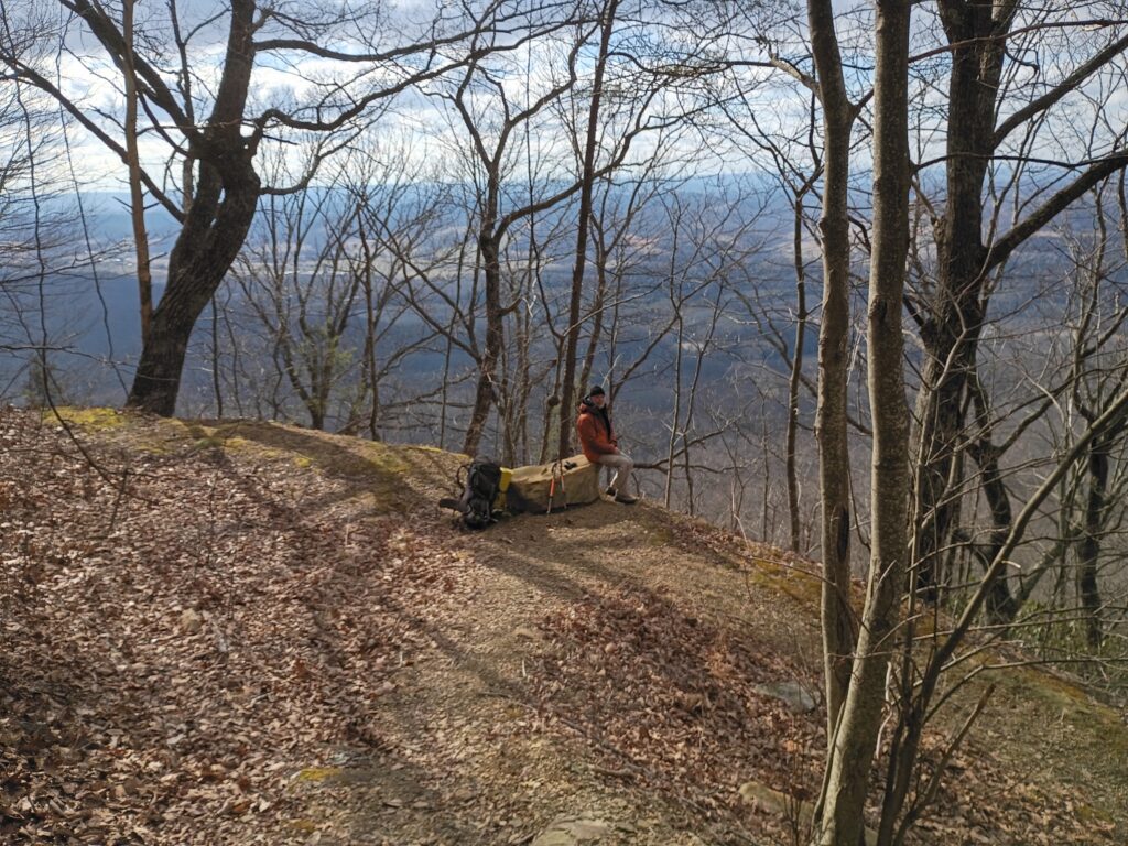
Saturday morning we opted to explore Hensley settlement and the local area instead of going out to white rocks and sand cave.. I’ve spent a lot of time in this area and made many jaunts out there.
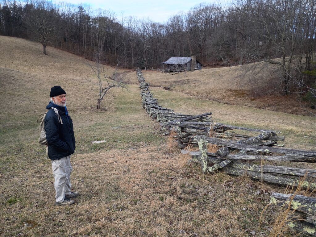
we had the entire place to ourselves.
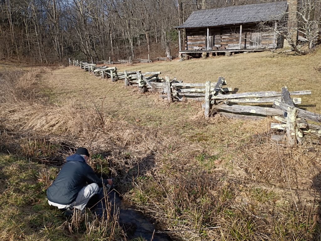
the vastness of this plateau and the rolling hills is a curiosity. Hensley and his group lived up here for many years.. it’s easy to see why.
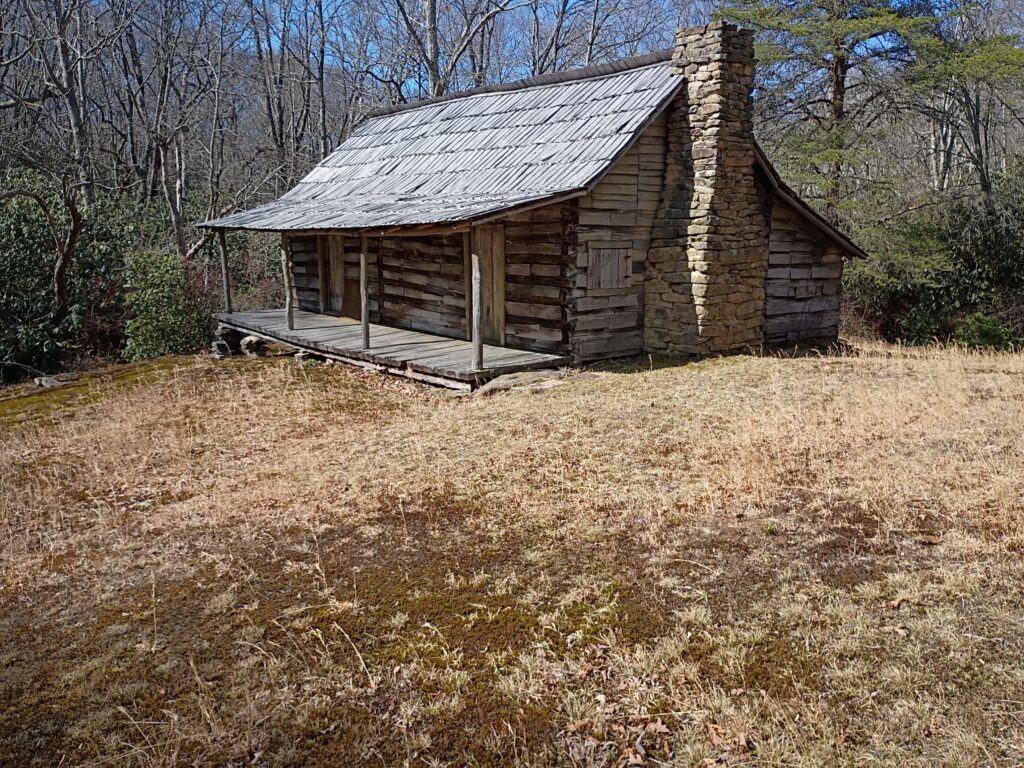
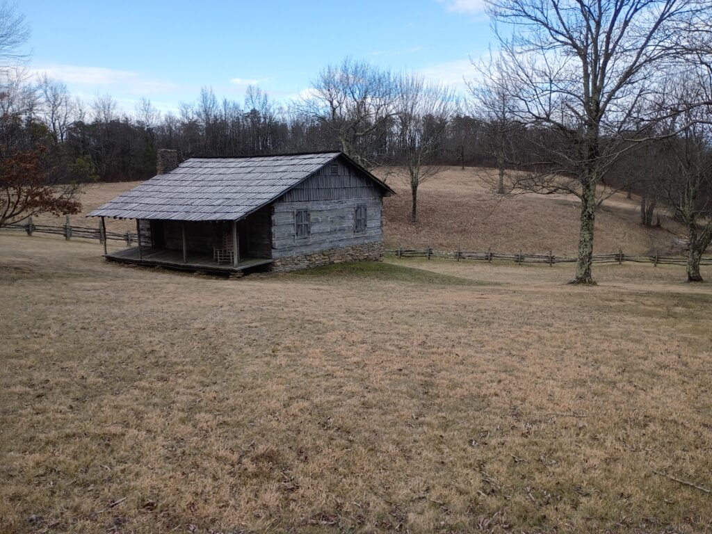
I found this cabin out on the ridge trail as I went exploring that area.
there are plenty there.
Saturday night the temperature dropped and the wind came in.. with a vengeance. It got down in the twenties and then the sleet started. Just drove us to our tents at an early hour as the precipitation pelted nylon.
when we woke up water bottles were frozen solid and so were we. So we made an early and hasty retreat from this mountain top abode.
I was reminded of the many many times when I was in this area with the Highlander crew. The old martins fork cabin is closed for business permanently. But I enjoyed the Hensley camp and the company of John Dempsey.
when I got back to the car the temperature was showing mid twenties. Maybe wonder how truly cold it got a couple thousand feet higher.
Come join me as I do a presentation for REI. We will talk about mountains and mountaineering.

Summit Orizaba

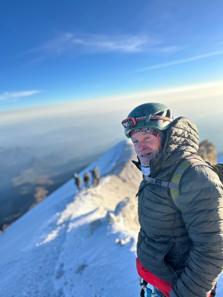
We had really good weather for our summit day.. and for the first time in all my years of leading people on these trips everybody on the team topped out.
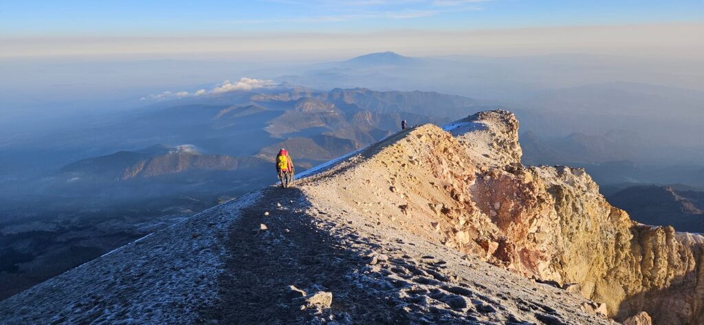
Kurt and Jeff Grindstaff were some of the first two to reach the peak that day. There were a lot of people on the mountain. It took us about 7 hours to reach the summit.


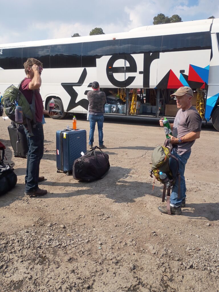
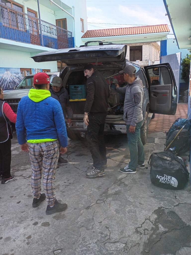
this trip involved a lot of logistics.. we landed in Mexico City and took the bus to Puebla and our bus broke down as we crossed the mountain.
when we finally made it into Puebla, we started working on La Malinche, our first hike.
the weather was cloudy which kind of worked in her favor although it did hail on us a little bit after we came down from the summit.

not many views were to be had until we reached the bottom.. and our awaiting taxi driver had run the battery down in his vehicle.


it is a beautiful mountain that dominates the Puebla skyline.
speaking of Puebla, the more I come here the more I love this place.
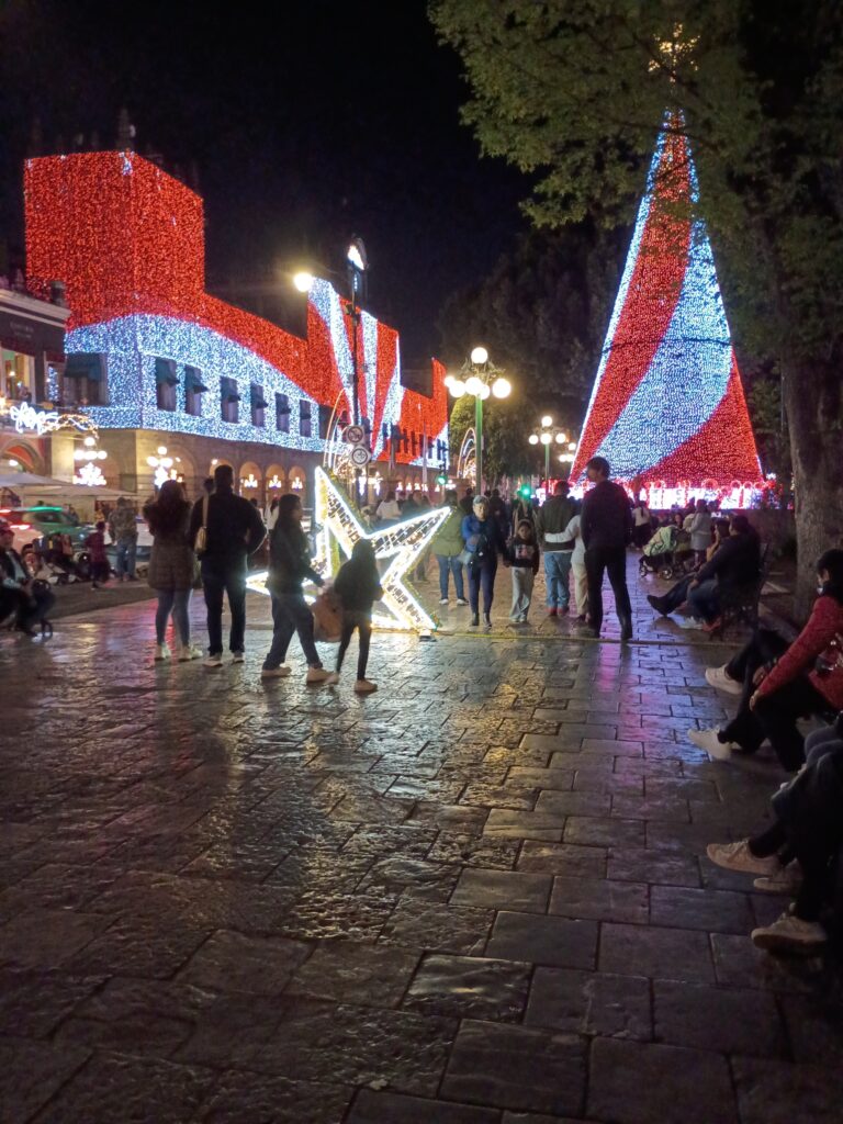
It really got me in the Christmas spirit.

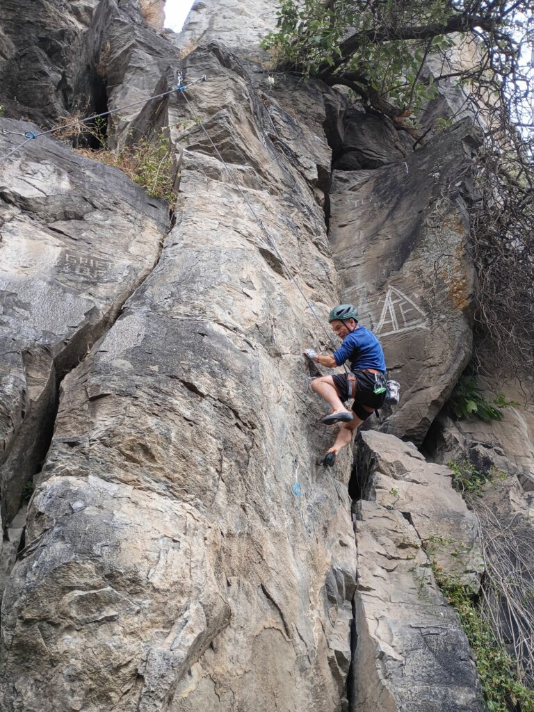
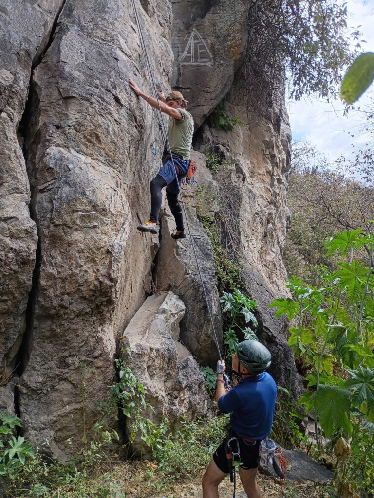
we made a side adventure in the form of finding some rocks to climb.. Los Pericos was an interesting place down by a reservoir.. I would say they’re probably 40 routes in here and The Rock was made of rhyolite. I’m glad we made this day.

our taxi driver didn’t have a clue how to get there so we had to use mountain project and route find to get here. But after about 3 or 4 hours he was waiting on us with cold refreshments. It was about an hour outside of the city. I didn’t want to carry a 10 lb rope over there but it came in pretty handy.
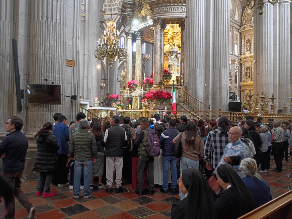
we managed to catch the mass inside the beautiful cathedral.

this was inside the beautiful cathedral at Tlachichuca. Those flowers just hit you with the smell from outside the building. So inviting.

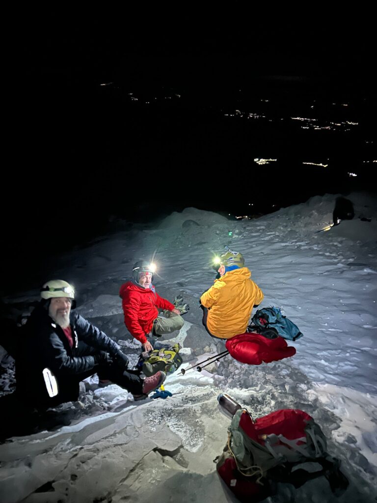
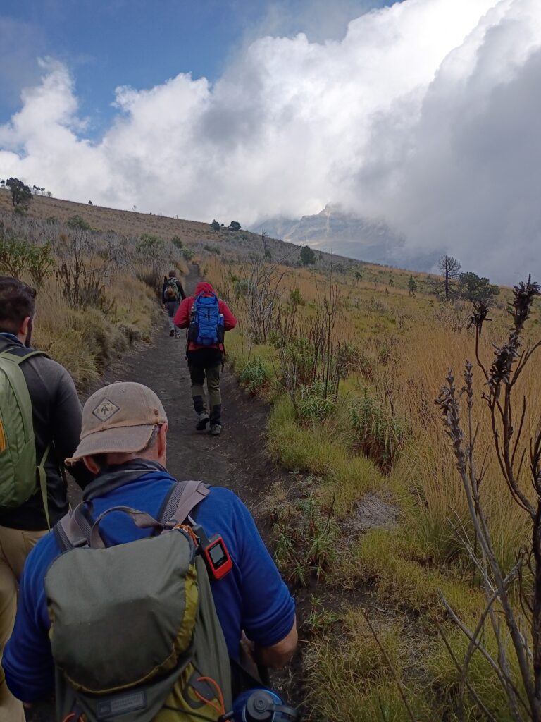
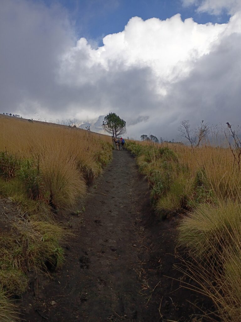
we had to do one more acclimatization height before heading over to Citlateptl, aka Orizaba. That’s where we hooked up with my old friend Danny Rios. He picked us up and took us to the National Park where we waited through the pilgrims and got to Izztacciuatl. I think we hiked about 8 Miles that day and climbed about 2500 ft. Both Jeff and Xenon were suffering from stomach issues. Which made their hike a little more challenging. Then when we got to our stopping point a pretty good hail storm came in.
we enjoyed the usual hospitality of the Cancholas family.

it was really organized chaos once you got to their compound.. they were hosting more climbers than I have ever seen in all my years of coming down here. But so gracious were Meribel and Joaquin. This was my fifth visit as their guest. They are like a Mexican family to me.

Joaquin, the Orizaba legend
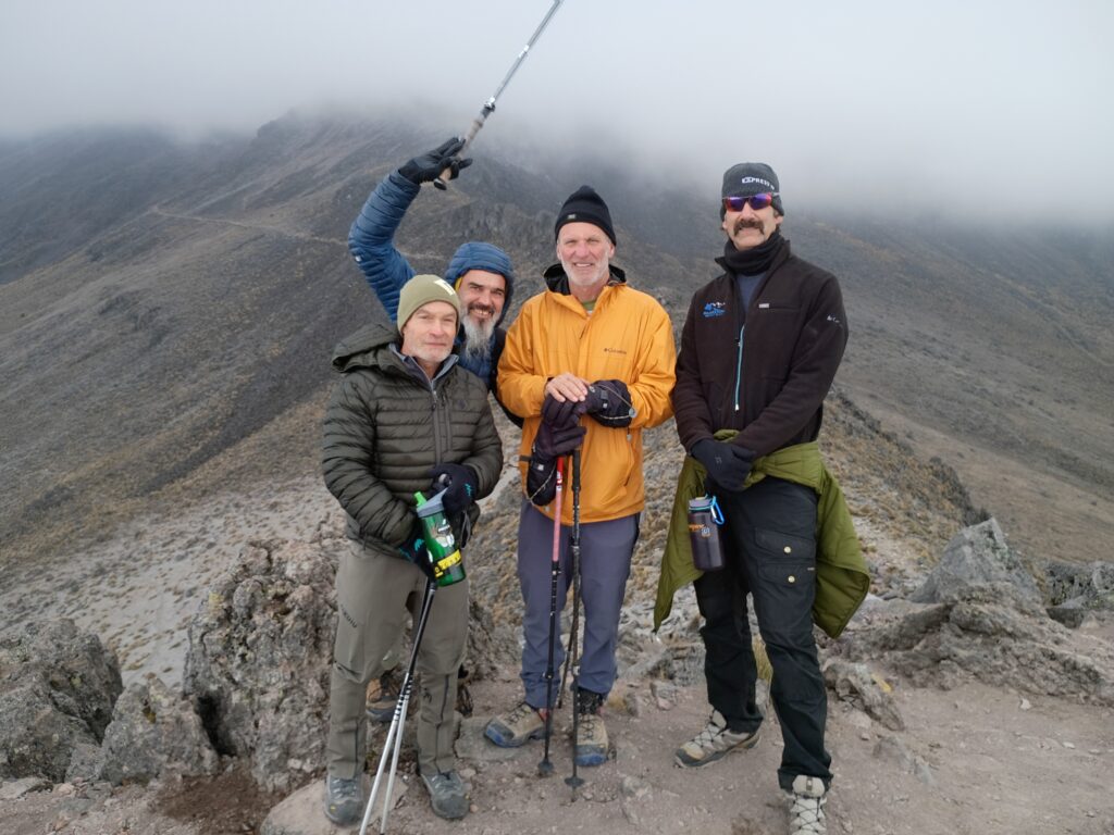
Very thankful for all the pleasant experiences I had and the great teamwork of Kurt ,Jeff and Xenon. We had some challenges but we also had a lot of opportunities. I’m proud that everyone made the summit of all three peaks.
Hangover 25

it is time for our annual migration. Climbing 2400 ft in 2.8 mi this is The Hangover.

and our coterie of usual suspects.

plus 1. Welcome Tim!

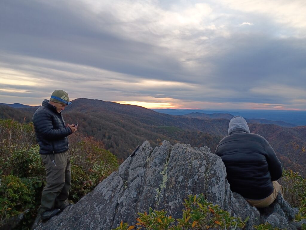
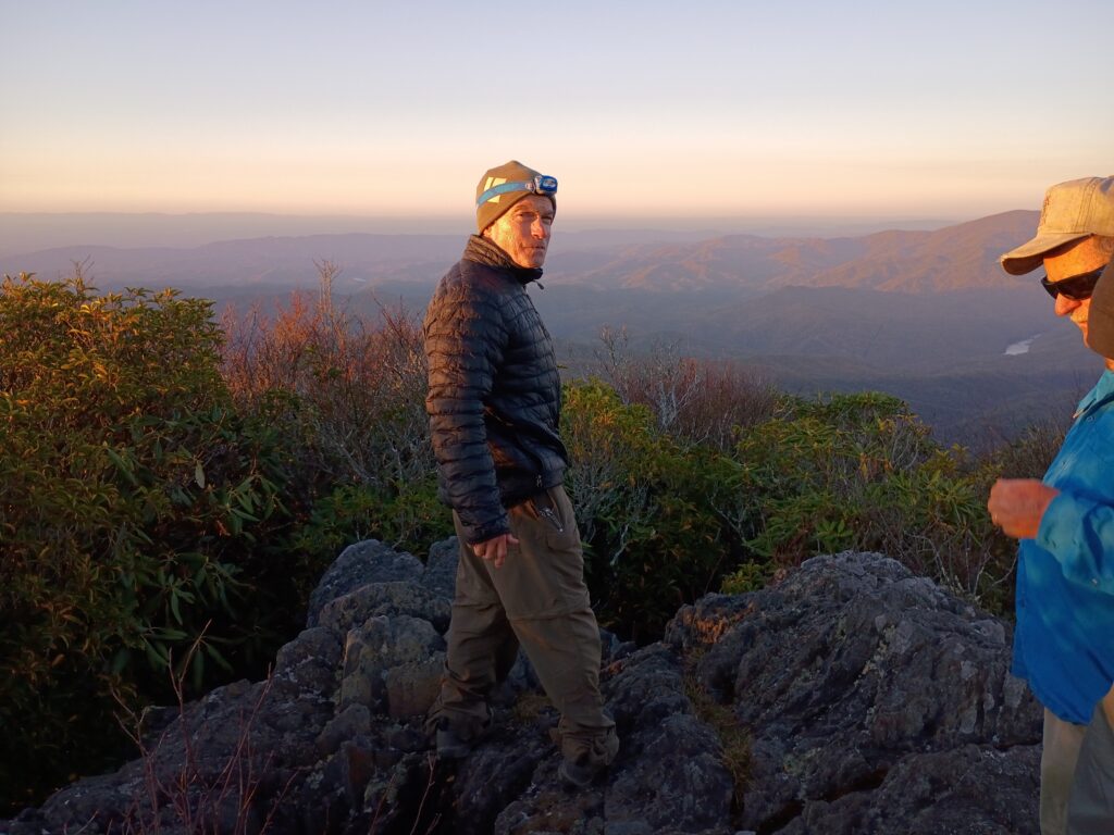
we literally watch the colors evolved before our eyes over the course of 3 days. Heading up on a Thursday we got to relax. I set a record for my heaviest pack ever up the hill. 64 lbs. I knew there would be no water.

we pretty much nailed the weather window so it was a good call by AJ to pick this particular weekend.
Jeff was a very welcome new addition as well. He made quick work out of our climb.

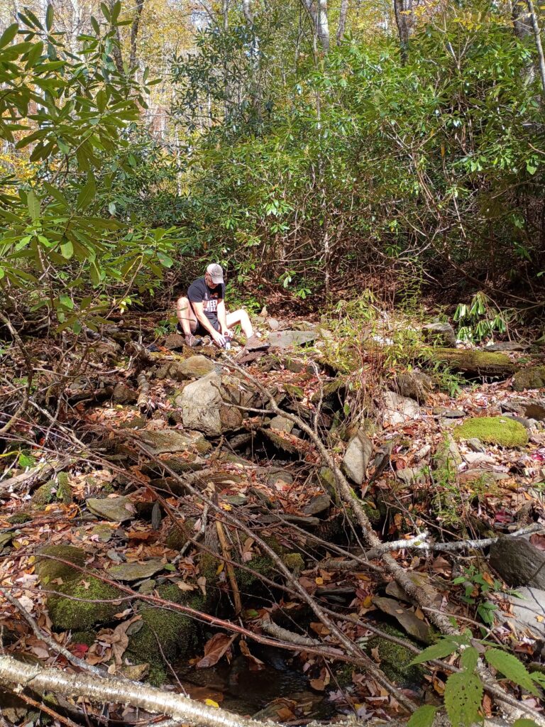
we had some beautiful fires sunrises and sunsets. But because it was dry up there we had to go down deep Creek one mile and 1,000 vertical feet. That made for another big carry on Saturday.
Chambers does the pumping and the carrying uphill.

John is ready to break out in song. Three Johns up here. You would think it a brothel.
the star photo belongs to Myers and it is stunning.

this of course is our shout out to the boys of the Muir faction. This tradition is theirs. We miss you guys.
which Monty Python character is being channeled here?

and so ends another glorious and perfect weather weekend atop The sacred ground of Hangover. I’m so thankful for this place and the friends who join me there.
updates
Greetings my friends.. lest you think I have retired from backpacking quite the opposite is true. I’ve been on several trips in the past couple of months, most notably the dolly sods, the smokies, and citico/ slick Rock. I tend to post more stuff on Instagram than here nowadays. However I thought I would touch base since a lot of people still come over here and check in. It is turning out to be a beautiful Fall, I think the leaves are going to be spectacular . (Bobs bald last weekend)

Something that I think is incredibly important is that the Trump administration is now planning to allow logging and roads cut on formerly roadless wilderness areas. This is an abomination but not a surprise coming from the likes of these politicians. Public comments were overwhelmingly opposed to this but they’re doing it anyway.. sound familiar? f you vote Republican then you need to be aware that they’re stripping and raping our environment.. this isn’t a both sides issue. If you’re an outdoorsman and MAGA then your ideals are at odds with each other.
And what I find to be the greatest surprise is that most of my MAGA friends have no idea about this. That’s because Fox News doesn’t cover it. And if you receive your news via Fox then there’s several other problems you to take a look at. Just the same way I would tell someone if they received all their news via CNN they have a problem.
Corporate media is the problem. Did you know that we have increased the billionaire class in the United States almost greater percentage wise than any other. And the reason our government is shut down is because they want to take healthcare from people like me so the billionaires can have a bigger tax cut. That and the fact they don’t want to release the full Epstein files. And we know why that is
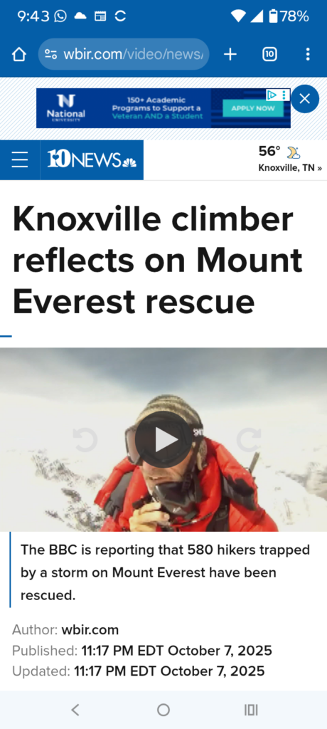
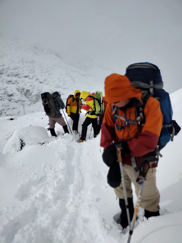
finally I’m sharing a link to an interview from WBIR about the people that were stranded on Everest last week. They’re kind enough to ask my opinion on the subject.
Do you want to join us in Mexico in December?
We’re going back to climb Orizaba and some smaller volcanoes December 4th. This will be our fifth expedition down there and it is dialed . Are you a sufficiently fit hiker, runner or backpacker? This is a great beginner mountain. Email me and let’s talk about it. The beauty of old Mexico and the camaraderie of our team awaits.
http://Johnquillenadventures.com
summit, Huayna Potosi

It was a hard fought climb, but three of the team members managed to make it to almost 20,000 feet, the summit of this beautiful mountain. Congratulations Joe Everett Richard hatten and Curtis Luzzi.
This was a trip that included Chacaltaya and Charquini summits in preparation for this elusive mountain. It was seven and a half hours to the summit for my rope team. And approximately three back down. This was from our high camp
Our summit day was 2,600 ft of climbing.
May/June Updates
It has been a minute, my friends. Not that I haven’t been busy. We are leaving for Bolivia and Colombia June 2 and I have a sizeable group in tow for the Andes. It is a very motivated group and we are excited to get back down South for a while and play in South America. Meanwhile, I have been doing day hikes and trail runs to get into mountain shape. In addition to my column for Cityview and regular office work and a big project at home, I haven’t devoted much to this space. My apologies. I hope to put up some pics when we get down toward La Paz.
In the meantime, this is my latest contribution for the magazine. Some of you Smokies oldtimers may appreciate these photos. I wish everyone a glorious late Spring and early Summer.
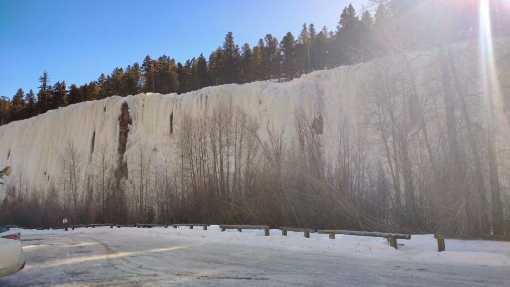
Winona, MN
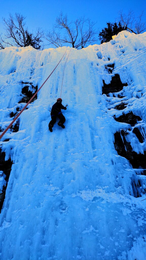
My new friend, David, takes one of his first laps on the Minnesota ice. You’d think hes been doing it his whole life.
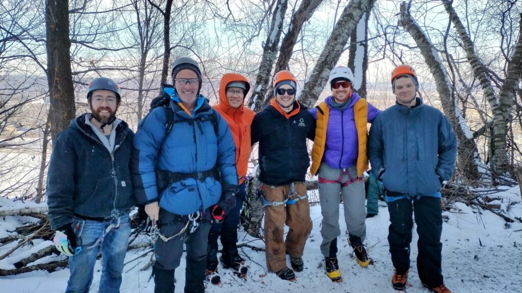
This was a long weekend and let me tell you how it started. I was sitting in the Atlanta airport on my return from o u r a y. Despondent about the possibility of that being my last time with an ice pick this year. What comes across my news feed but a story about the Winona ice area. That was enough to catch my attention but as I dove into the article they had interviewed my friend, Lee Ein with the Chicago mountaineering club.
Lee had conscripted me to do a presentation for the Chicago mountaineering club several years ago. He had also been a guest in my home. So I reached out to him and he immediately invited me for their upcoming outing two weeks hence. I started the frequent flyer mile calculation. I could go up there and meet them for a couple of days. And so my plan was set.
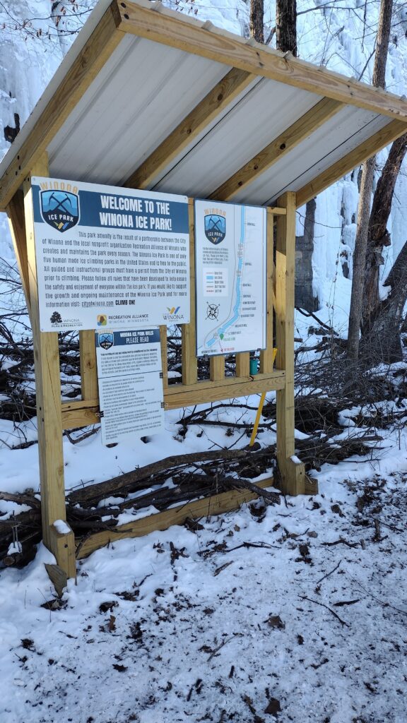
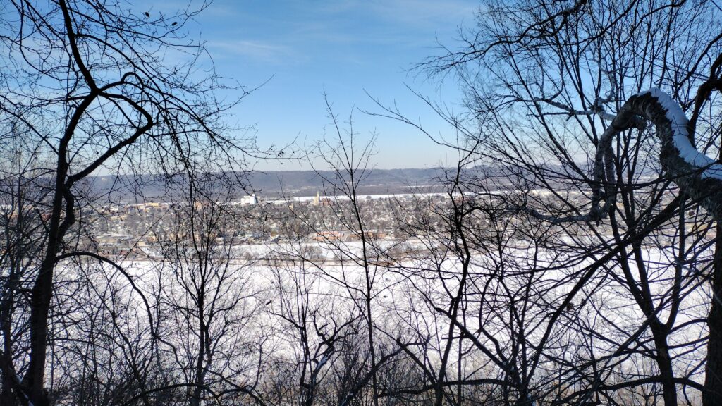
This is a fairly small area with about a 20 minute approach. Perched atop a hillside overlooking the Mississippi River and across into Minnesota, there are probably 28 routes here. This ice is partially farmed.
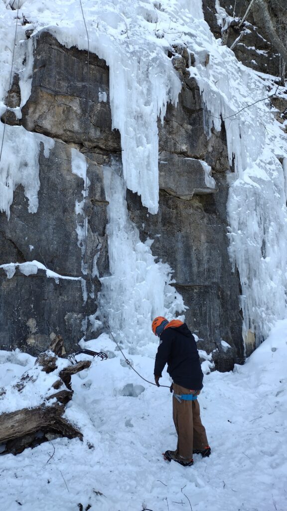
As you can see, there’s a lot of mixed routes in here. It was pretty cold, especially compared to the high temps in Colorado. About 13 degrees in the morning. They had probably 15 folks there with the club. And what a fun group to climb with.
I got in some laps on Friday and really smoked myself out on Saturday. The screaming barfies are a real thing when you over grip on some of this wi 4 and 5.
it was a big travel to get up here and back. I drove from Minneapolis which was 2 hours. That is after flying from Knoxville to Chicago to Minneapolis.
But, worth all of it.
I’m so appreciative of my friend Lee In and the Chicago mountaineering club.
And to the ice farmers of Winona.
just another example of how developing outdoor opportunities brings in tourists from all over. Perhaps one day Knoxville will realize this about climbing.
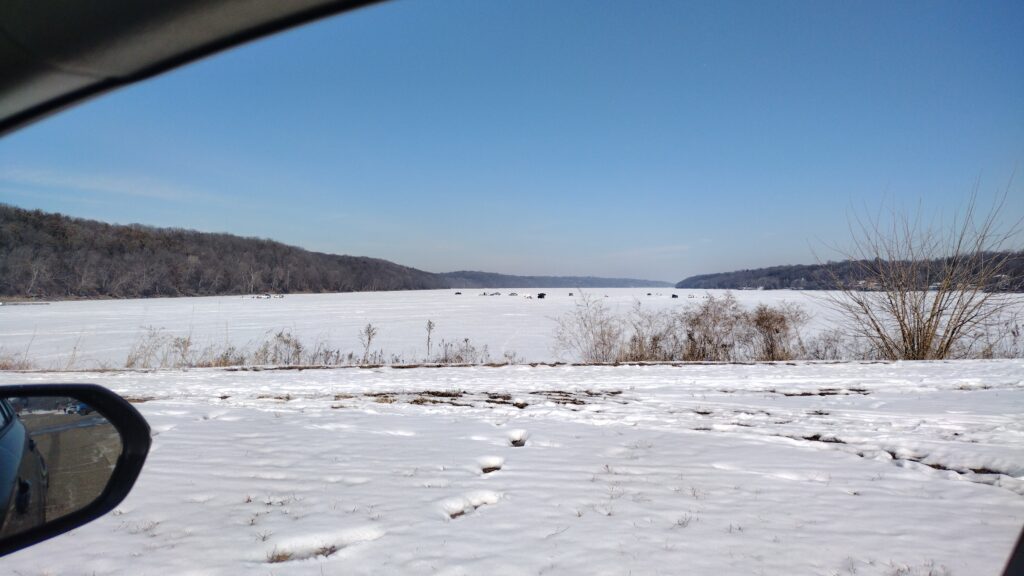
ice fisherman on the river.
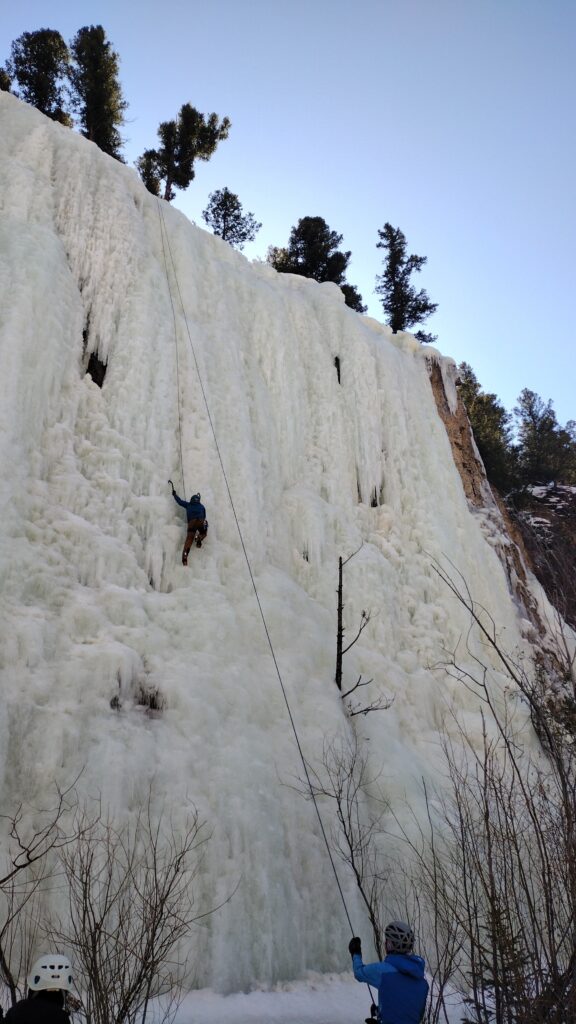
Ouray and Lake City
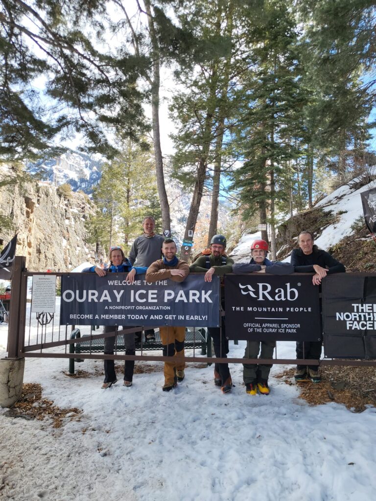
we had a record turnout this year for the ice event. And the weather was magnificent.
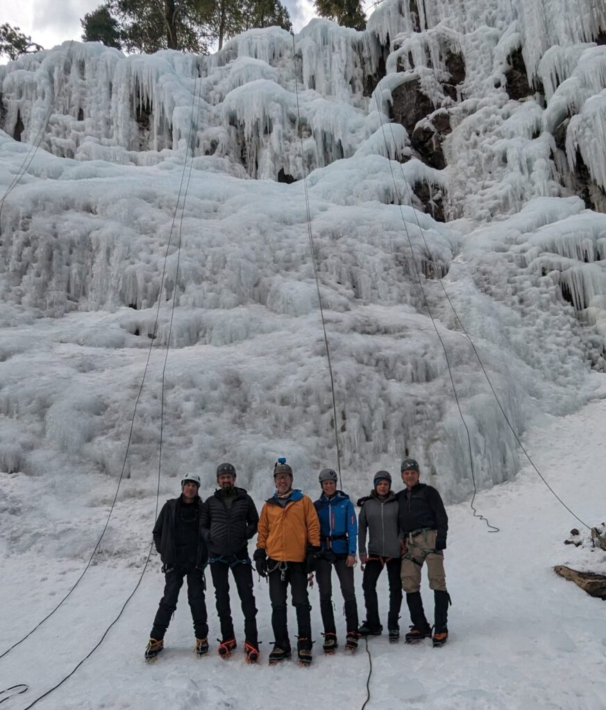
Frank and I arrived first and I managed to get in seven consecutive days of climbing.
On the second day, Sara,Caleb and several others came trickling in,. That’s when I had a little incident.
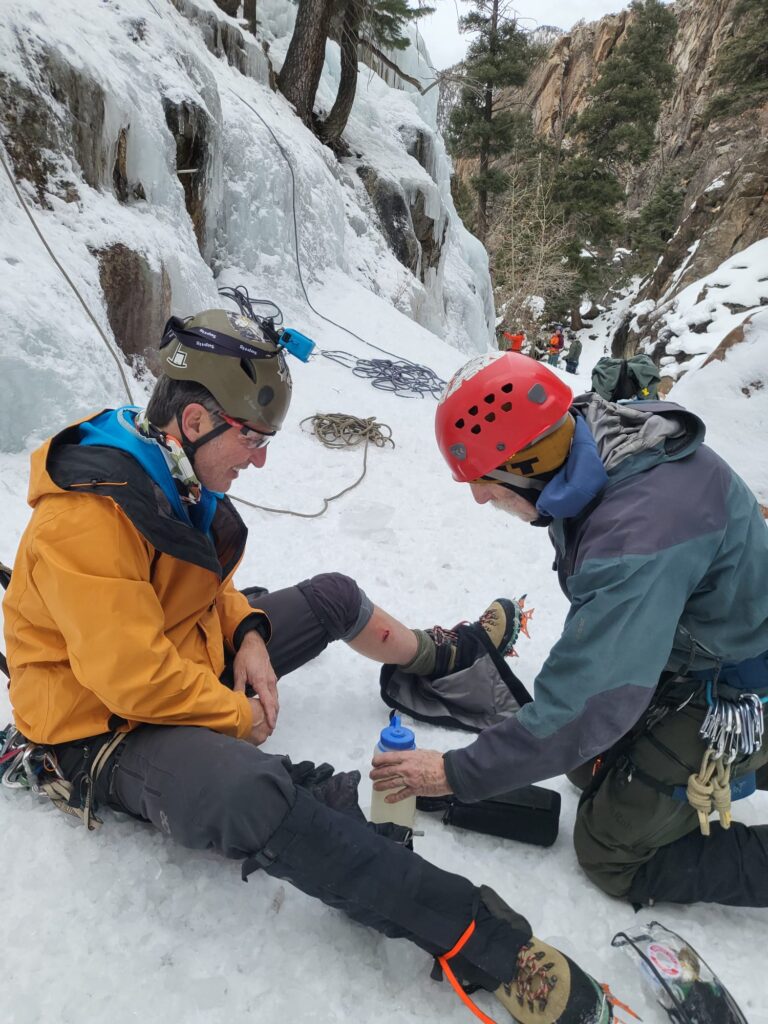
it was a freak accident as I was being lowered from the top of a climb I just finished. Too much slack was in the line and it flipped me over backwards and in the process of kicking out from the ice one of my FrontPoint crampons went straight into my calf.
so I was hanging upside down and backwards with a cramp on sticking straight out of my leg. 40 feet up I had to pull that thing out of my leg which caused a little bit of damage in a lot of bleeding.
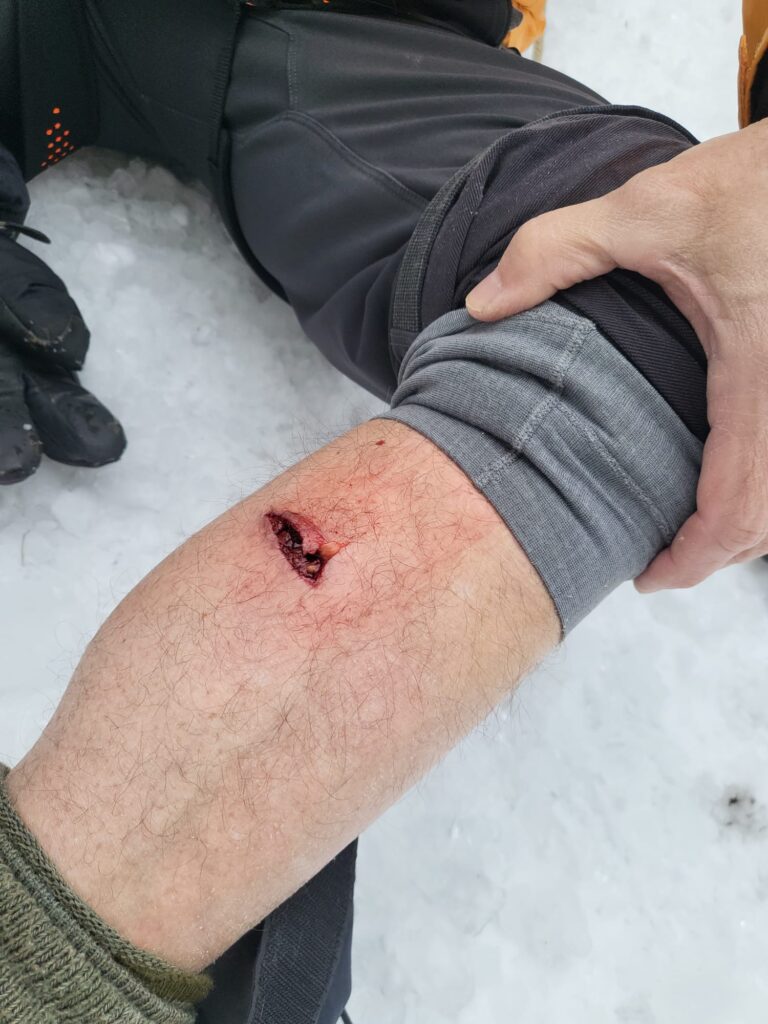
Fortunately we had a team doctor on board. Neil was Johnny on the spot bandaging me up. I managed to miss the bone which was fortuitous.
that night we did civil war battlefield surgery.
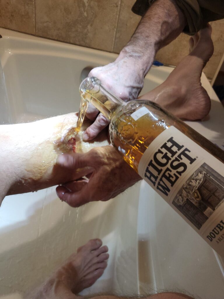
Neil, Sara, and James did such a good job that I managed to climb every day thereafter. Given the open wound, though, I had to forgo the hot tubbing.

on one of my next to last days of climbing I ran into an old friend with whom I was in Tibet China and Nepal with back in 2016. This is Edwin. We had been climbing together all day before I realized who he was and we made the connection. I was climbing Cho Oyu and he was going to camp 3 on the north side of Everest. I kept looking at him thinking he was familiar to me. Edwin is a screenwriter who now lives in salt Lake City so they were down for a long couple of days of climbing.
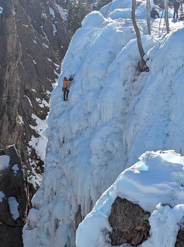
Neil prevailed upon us to take that 2 hour 50 minute drive across the state to visit the new ice climbing area called Lake City. Five of us crammed in the vehicle and away we went. It was beautiful going over the frozen lakes and seeing that part of the state. I will say the climbing there is primo. The temps are colder and the elevation a bit higher. A lot of stuff was melting out in o u r a y. Here it was cold and winter still retained a firm grasp. There are long runs almost 80 ft. Definitely enough to get your pump on. We liked it so much you’re going to incorporate it in future trips. Well worth the drive
we got back for our final day on the ice. There’s several side notes to this trip. One of which is that Richard and Linda got engaged. The other is that Caleb’s vehicle broke down somewhere outside of Kansas. So we spent a lot of his vacation dealing with that headache.. I’m very sorry for what he had to go through.
that’s me on berserker one of my favorite climbs off of the pic of the Vic.. James and Richard took great photos.
overall I’d say it was an amazing trip. If you didn’t go you missed out.