


Deep Creek and the Holiday Hell
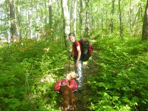
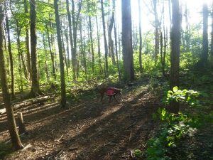
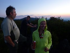
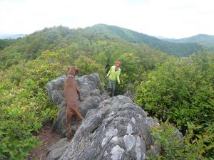
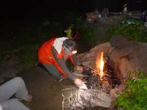
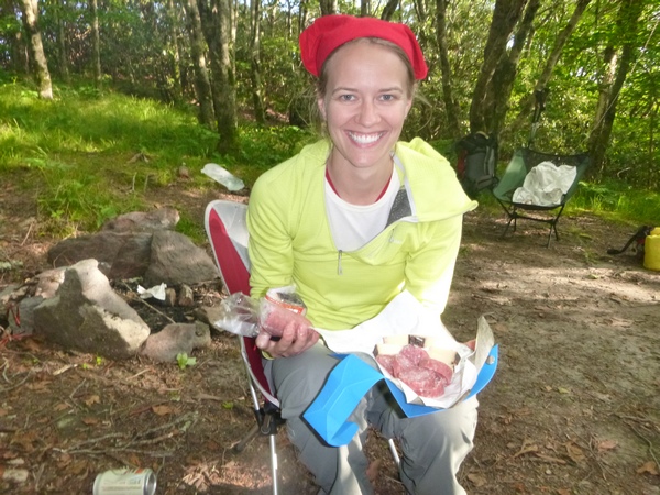
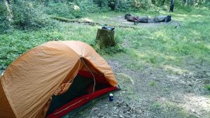
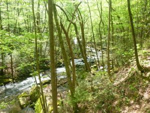
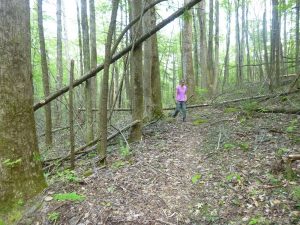
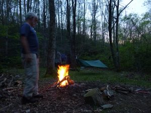
We were indecisive about our July 4th weekend plan. The weather was sub optimal so we determined that waiting until Sunday would obviate some of the crowds and rain. We settled on a plan to car camp at Deep Creek so Laurel could get her miles over there. ( I have abandoned any semblance of finishing my second map even though I probably have less than 20 miles remaining. ) We fought a monster bear jam on the Newfound Gap road and arrived in Deep Creek car campground after noon on Sunday. As expected, it was a zoo full of idiots. Dogs competed with children to see who could outbark each other. Tubers floated lazily, cigarettes in hand along with their lap dogs and children. Laurel and I strolled about to find a tent pad. There are many reasons to despise car camping. It is akin to shelter stays in my book. It attracts those who need creature comforts. Personally I find it more of a headache than not.
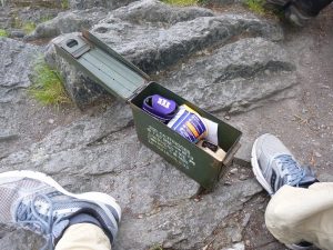
It did afford me the opportunity to fulfill one of the Southernhighlander covenants. And that is the special skill of appearing in the flames of campfires unexpected. As we walked around in search of suitable digs for the evening, I spied what can best be characterized as the main reason I modified my backcountry associations some years ago. Alone, likely stoned and sorrounded by dogs and a daytime smoker, the drug dealing geriatric pretended not to see us as he made a beeline for his car knocking his noontime beer over in the process of escape. Laurel noted that perhaps he was going for a gun. I said he was more likely going for another zanax and depends undergarment. We ended up planting ourselves not far from that area, there was little from which to choose on this extended holiday weekend.
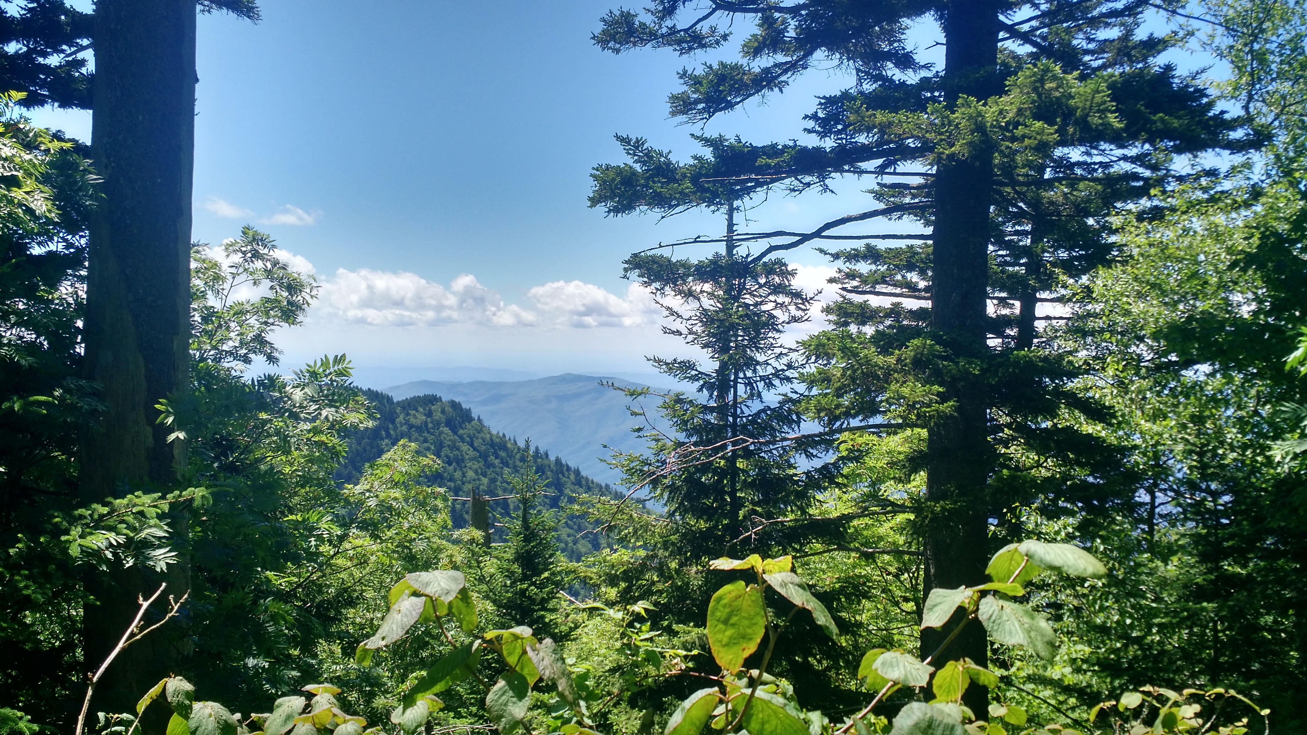
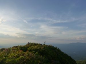
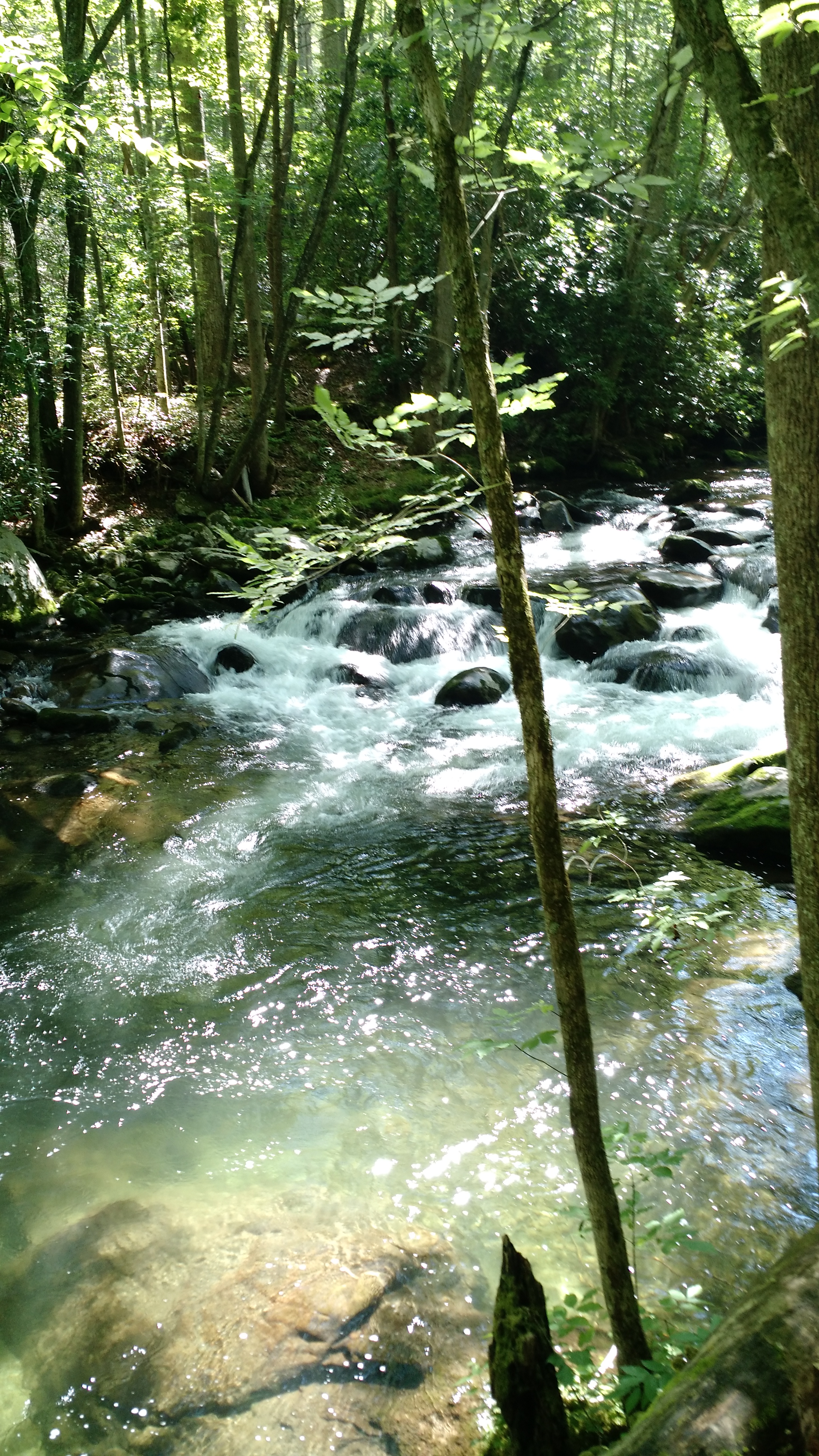
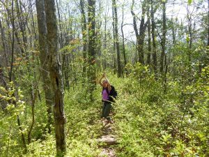
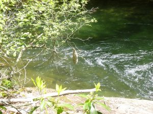
I now knew that there would likely be other familiar faces from the old group about. As we erected the tent, I prepared for a trail run. Deep Creek is a great place to click a few miles so I headed up toward the Indian Creek Motor Loop. Before long, I had passed the infinite line of inner tubers and cyclists and was enjoying some moderate climbing up past the split for Stone Pile Gap. After an hour or so, I turned around to descend back to the “mayhem”. There were fishermen, hikers, backpackers and photogs. It was a jam packed Deep Creek experience.
Rounding the corner where Deep Creek trail passes over the water is a bridge. On it were two more familiar faces that I had not seen in about two years. It was clear they had not expected to encounter me emerging shirtless and covered in sweat from the backcountry. 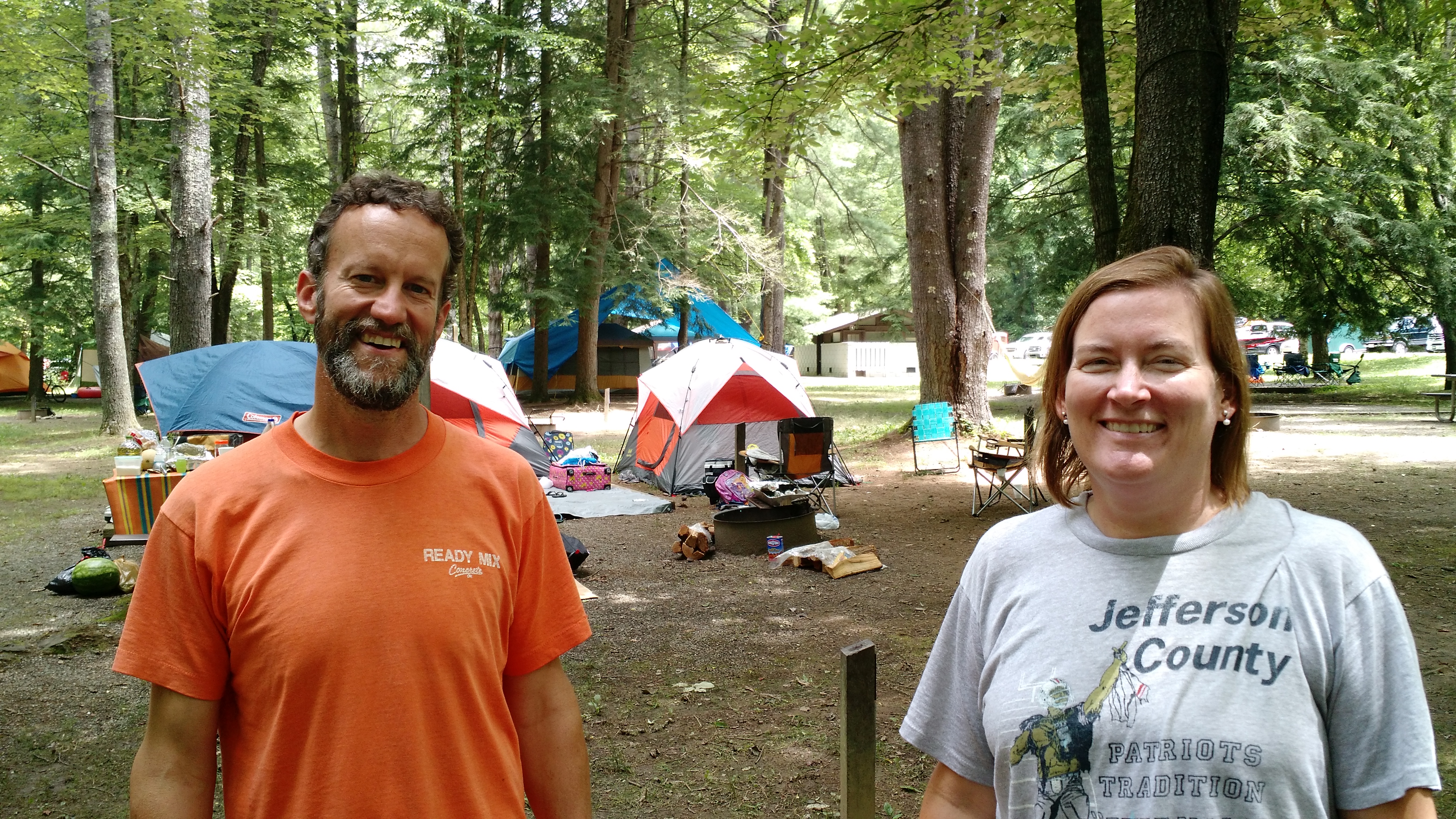
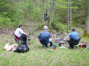
It was the Trail Bailer and Jenny. I returned to camp and they came over to visit and catch up. There was a lot of catching up to do.
Laurel and I decided to go into town and chase some pizza in Bryson City so we bid farewell to the Howe’s and missed the pizza place by 3 minutes. We were on the verge of missing food altogether until the owner of the sports bar agreed to feed us. I was ravenous after a 6 mile trail run. We retired early in hopes of Laurel embarking upon her quest in the morning. The night-time arrivals next door saw fit that sleep would not occur as they banged on tent poles and yammered in Spanish from midnight until two am.
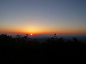
Morning saw neither of us moving far from camp as I pressed coffee and lounged about. Jenny and Will returned, having suffered the same fate in their site with two German Shepherd dogs competing with the children in that area. Laurel packed up for a 10 mile trek around the notoriously unremarkable motor loop. I love hiking and she later remarked, ” I should have known when you declined to join me on this one, it would suck.” And the motor loop really does suck. I did little that entire day but lounge around camp, visit with Will and Jenny and drive up to Stone Pile terminus. It rained while I was there but I decided to amble up to the cemetery and lay in wait for Laurel who was scheduled for a 5 pm appearance. On schedule and fighting sprinkles, she was subsequently sprinkled with a bigfoot laying in wait.
It was collectively decided that another night in that maelstrom of humanity was more than either of us could bear. Laurel had already done Leconte and Brushy mountain trails day-hiking last week. It was solid mileage for the mileage queen. Given that we both had trips upcoming it was agreed that we would head back over the mountain.
If you didn’t get a chance to see the monster bear video click on last weeks blog post. Laurel has also posted another bear video from Brushy Mtn. She saw three more on that trip. They are active.
I will be in Colorado next week, so expect some pics of Western Slope mountain fun soon.
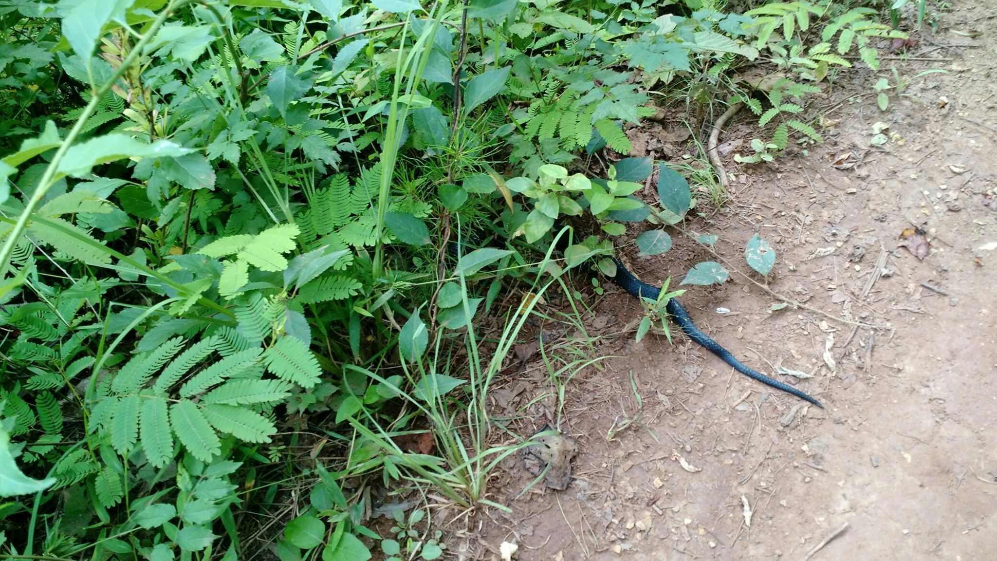
One can’t help but absorb the potential symbolism. For me, the king of snake enounterers it was time to quit ignoring the messages. The universe speaks to us in many ways. I have a gift/curse for snake encounters so well documented through the Southernhighlander pages that a certain notoriety has developed as a result. This guy crossed my path on Tuesday as I rode the mountain bike through Baker creek preserve. My three riding partners had just called it a day. We had been launching off the table tops of Cruze Valley and Barn Burner downhill runs. Before the July 4 rains enveloped, I was alone on the acreage when I rolled up to this fellow. You only see his tail, and this is a frequent position for black snakes in my world. The tail was the tip of a longer serpent, beautifully marked with white marbling rolling across his scales.
A snake crossing your path could, at first blush, have many negative connotations. However, ancient wisdom holds quite the opposite. Across the board, it is generally considered a sign of metamorphisis and shedding of old skin. Contrary to popular belief, snakes aren’t necessarily bad. Numbers 21:8 The LORD said to Moses, “Make a snake and put it up on a pole; anyone who is bitten can look at it and live.” This was of course in response to a plague of snakes and snake bites. I’ve heard preachers struggle more with that particular symbolism than just about any in the Bible. Snakes have long been regarded in Eden terms.
But for me, the consistent crossing of my path by snakes means much more and particularly in context of that weekend. Snakes symbolize healing, a connection with the earth, awareness of surroundings and shrewdness. When Jesus dispatched his disciples, he conveyed the following dispensation, 16 “I am sending you out like sheep among wolves. Therefore be as shrewd as snakes and as innocent as doves. 17 Be on your guard; you will be handed over to the local councils and be flogged in the synagogues. Matt 10.
Snakes have long held a high place in native American lore and rattlesnakes, especially, are considered good luck charms.
Earlier in the day I was rounding another corner and startled a hawk that had a freshly killed rabbit. He picked up that animal with a talon but was unable to fly with this meal that probably approximated his own weight. Because I was on the mountain bike, he had little time to escape with his bounty. Whether he was feeding or just killed the animal is undetermined. But to the treetops he retreated as my biking buddies rounded the corner and I related the tale. They spied the fresh kill and reveled in the grandeur of nature that is often cruel and powerful but equally awe inspiring as the hawk patiently awaited our departure.
In nature is strong symbolism embraced by all religions of man. Losing our connection with nature is the genesis of many psychiatric disorders. ADD/ADHD did not exist a few decades ago. I struggle to compete with video games when we take alternative school kids to the Smokies. The ones who make any sort of connection with the natural world are, to me, fixable. Not that the others are not. But like the black snake, we need to feel the rhythm of nature, move shrewdly and with little impact upon our environment and share our healing powers with fellow man.
These are gifts sorely needed today when our faith is placed in leaders and political figures who have never experienced any connection whatsoever with the natural world. Of course someone proposes cutting the Environmental Protection Agency who has never been into the natural environment. Of course political leaders support re activating coal mines and dropping out of the Paris accords when they have never left an ivory tower and are bowing to corporate interests to the detriment of all other humanity.
It is not a revolution until there is blood running in the streets. When 20 million people lose their health care so a bunch of millionaires can receive a tax cut, that time may be nigh. And if it happens, then we will be shedding skin collectively. As someone who has experienced the shedding of skin, I can attest it is painful and at some points blinding when that last bit covers your eyes for a spell.
But what is left is a new skin and fresh eyes. It is our job to see what we are supposed to see instead of what we are told to see by false prophets and corporate charlatans with agendas to match their egos. For someone with children to support the aforementioned policies is blindness of an unfixable sort. But the sins of the Fathers will be visited upon their brood. Be wise and shrewd and good stewards of our environment. We are judged according to our treatment of this sacred trust.
John
Leconte Marathon and Monster Black Bear
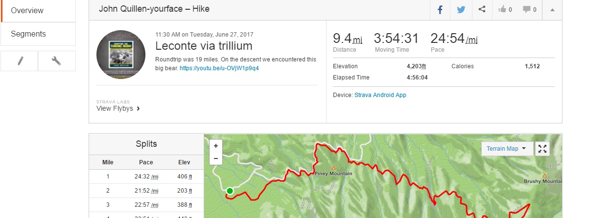
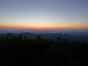
We decided to do a marathon up on a perfect day so 19 miles was our final tally. You may be asking, “how 19 roundtrip to Leconte?” Well, if you do the “True Trillium” trail starting from Rainbow Falls, it is 19 miles. And that was our day. It was anomolous in that the weather was somewhat chilly even in the valley. True Trillium parallels roaring fork and Cherokee orchard roads. It was coming back when we encountered one of the largest bears I have ever seen.
Of course, I couldn’t just do a dayhike. I had to make it more by adding a 25 lb pack filled with water, snacks etc.
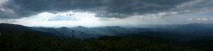
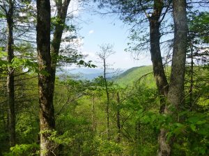
Dr. Dunn had never been to cliff tops so we topped out to a view that afforded a real insight to the Smokies wildfire of last fall. The Chimneys were definitely altered to great significance. As you can see with the strava profile below, we made good time in our near 20 mile day. If you are not using strava, I suggest you put in in your tool bag. I employ this free app primarily for mountain biking but it is becoming quite handy for backpacking as I have been able to map data from Frozen Head and now Leconte. Cell service in the mountains is improving, which is bad, but good for use of strava to log your data.
Late yesterday afternoon, we were hitting the Bataan Death march portion of the dayhike and suffering through the final three miles back to Rainbow. I spied something ahead and this was what we encountered. He was an ever loving monster black bear. Kudos to Laurel for capturing this video.
Hangover June
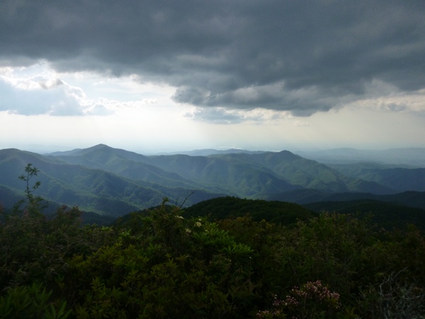
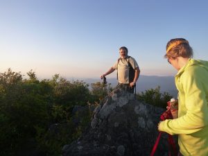
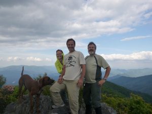
 We Highlanders never tire of Hangover and its blessings in all seasons. Our friend, AJ, wished to spend his 51st birthday on the rock, so we accompanied him to the sacred spot.
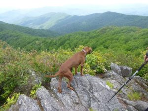
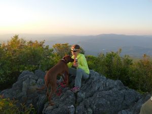
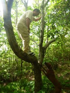
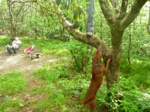
It was time the hound earned his keep. And with a fully loaded pack of my liquids, he made some headway.
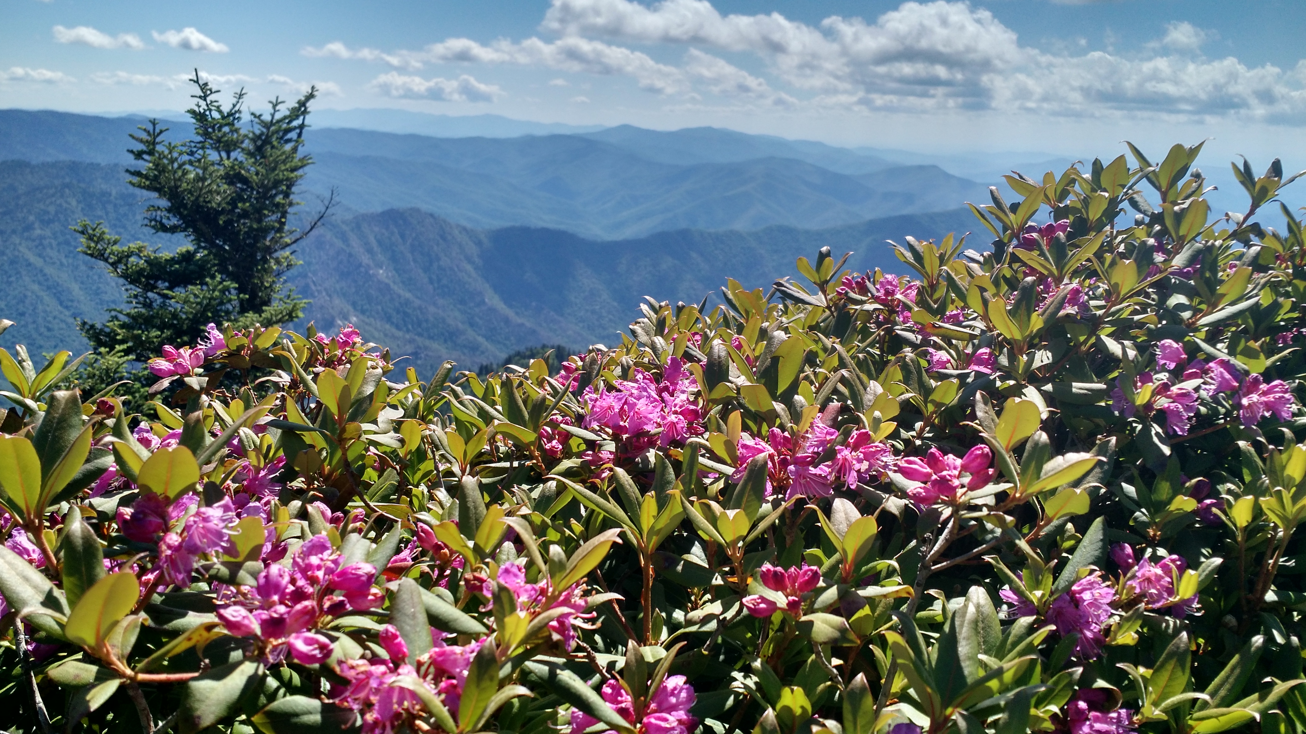
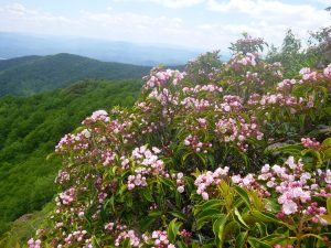
 Flame azaleas on Lead South were a welcomed surprise on Friday afternoon as we disappeared into laurel and rhodo for three days of bliss.
The trail was in spectacular shape considering the great storm damage from weeks ago. We made good time in our ascent of the traditional pathway to the most beautiful summit in the South.
 We met AJ on the rock and he was the company of another Highlander friend.
 Yes, its the legendary Patman. Patman has met us and run into us on multiple occasions on the Hangover and elsewhere. Needless to say, Patman, like many others, were relieved that this was not going to be one of the old Hangover bacchanals from days of old. When I assured him there would be none of the drug fueled festivals from which I and others have so assiduously distanced themselves, his relief was palpable. Patman was going to drop down and meet Tipi somewhere near Yellowhammer the next day. He actually carried a 15 lb watermelon up lead trail. That is a feat of great pride. Patman puts in considerable time on the trails and is a gear tester for trailspace.
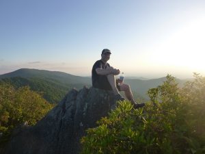
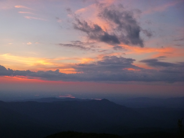
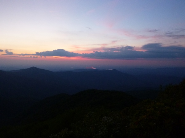
 We communed in the cathedral at magic hour.
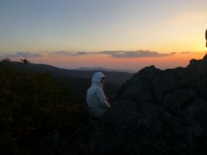
 Is there ever an ugly sunset on the Hang?
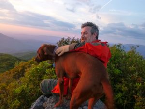
 Longstreet climbed down the rocks that lead to the Holiest of Holies. Then he climbed back up. And did it over and over. I know humans that can’t climb down there. We may have found his redeeming quality.
 Saturday was AJ’s birthday and he reflected on 51 years of life.
 … And we convinced him NOT to jump.
 There was too much remaining beauty to behold.
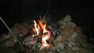
 It was cool at 5200 feet so a fire was in order. It is always cool on the Hangover.
 All I did was get up to go to the bathroom. You would think he had treed a bear.
 I figured he could have scaled that tree after his heroics on the Holies.
 I found the old geocache on the Hangover. In it is a book that outlines several of our trips up there, along with varying items through the years.
 We sunbathed and moonbathed up there, since both were full at the time. No rain at all. Bugs were minimal.
 We moved the fire night two a bit closer to camp. Did I mention that water was flowing? It was a gamble. One that paid off with the recent storms.
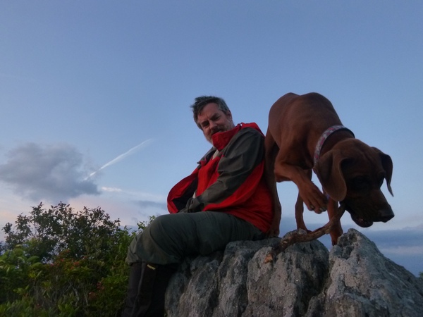
 Even birthday boy warmed to the General.
 Nothing but magic on that rock.
Shout out to the Muir Faction. The meat and cheese board lives thanks to you guys.
 My only complaint about climbing to the Hangover is the amount of photos I have to cull.
Happy birthday to AJ.
Peace to all. As John Muir said, Climb the mountain and receive its good tidings.
-John
Synchronous LIGHTNING BUGS. Because no local ever called them fireflies.
 The water was inviting so I availed myself of the opportunity.,
 It was a great day for bikepacking into Elkmont. I went solo. My absence from the Smokies has been situational. Several trips have been cancelled due to Spring storms. Last weekend was a doozie and judging by the after effects, am appreciative to have slept indoors instead of campsite 15 as planned. That makes two recent trip plans upended by weather.
 There was one spot remaining at 24. Our usual lightning bug viewing site is closed for bear activity. I had been craving a solo night in the woods. I would not be solo, however.
 Although my intention was to interact with the infamous insects, these were the ones with which we all had to contend. A swarm of honeybees infiltrated the entire drainage. I spoke with a guy who got run out of campsite 30 because of the intensity of bees only to find them equally thick at Rough Creek. And they persisted from dawn to dusk. I have never experienced a bee issue of this magnitude. It is reminiscent of the black fly hatches I also seem to nail with equal precision.
 Anyway, I found some solitude along this beautiful spot full of memories. My first true backpacking trip outside of the scouts was with my friend Chris when he got his driver’s license. We took off to this campsite and fished. I remember catching a small brook trout on my second cast and with that it was I who was hooked. I figure this was sometime around 1981. No true count exists of how many times I have stayed here but it must be nearing a hundred. (There are likely 30 on the Southernhighlander site)
As the afternoon sun began to drop, a couple from Ohio came down to ask about the bee phenomena. They noticed I was now bee free so I suggested that Maggie and Everett take a swim. It is the salt to which the stingers are attracted. Soon the pyrotechnics began slowly about a half hour into 9. With rolling crescendo a cacaphony of silent and initially muted lights began to ebb and flow in chorus. As I explained to my neighbor, John C from Cincinatti, it is the stopping that is synchronized. No matter how many times I witness this miracle, I am humbled by nature’s majesty. Soon insects had infiltrated my treeline and light free campsite. I was enveloped in their swarm and carried away by the symphony.
No photographic evidence exists, though I made great efforts. Forty five minutes of gopro were wasted trying to share this with Laurel who is out of town. I believe that the lightning bugs are only to be experienced first hand and look forward to taking her into that din. As the hour approached midnight the Christmas blinking diminshed as I fell into my tent with the vestibule wide open. My eyes drifted, losing a battle with the urge, but the twinkling still was visible as I fell into a trance.
The sun showed up at 6 am and breakfast was simmering by 7.30. After all, I had to feed all those well rested bees. By 9.30 they had run me out of Rough Creek and a beautiful stroll was reward enough. That, of course, entailed another swim at the Husky Gap intersection. I thought about the Muir Faction. We had scheduled a backpack into Goshen several weeks ago when the big storms closed the park. Chuck and Ledge were stranded in Townsend at a hotel, their trip to the Smokies thwarted by Mother Nature.
Ironically, I received a text from Chuck Adams and it was a picture of a black snake. He thought of me. The irony is that while he was sending me the picture, I was on the motorcycle departing Elkmont. About halfway down the road before you reach the Little River road, Brian and I came upon this big black snake years ago and we stopped to move him from traffic. I was thinking of this as I rounded the corner, and guess what?
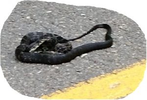 In the exact same spot. Could it be the same snake? Snakes are following me, falling on me and nipping at my heels. Skeptic? Read below.
Apparently I am quite the snake whisperer. More people equate me with snakes than anything. I’m not one of those herpetological freaks but respect them and tend to be in the snake place at the snake time. On the way over the day before I narrowly missed another big, likely five footer, black snake draped across the pavement in Sevier county.
However, the big serpent tale comes from my So Knox abode. Upon entering my shop building two weeks ago, this gal dropped down almost on my shoulders. She was halfway between the door and the frame. When I cracked the door she fell right across my arm. My response, slamming the door shut injured the creature. Anyway, she wasn’t happy, as you can see. Notice how she is able to make her tail rattle leaves to mimic a viper. Why do I think she is a she? I am told that the females are aggressive during birthing periods.
” ]
so in summary, it was great to get into the Smokies again. Mostly. I could have done without the bees but Lightning bugs were the focus and disapoint they did not.
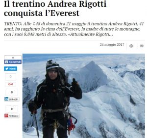
Andrea summits Everest
I am very proud to announce that my climbing partner and good friend, Andrea Rigotti summited Mt. Everest on Sunday. His dedication to this goal has been inspirational and his olympic training regimen has paid off. I am very proud of Andrea for this monumental accomplishment, We began on Muztagh Ata together in 2011 and climbed Cho Oyu as a team last year. Andrea embodies perseverance and focus and I congratulate him on his hard fought victory. Andrea climbed the North route with Arnold Coster Expeditions. He was accompanied by our mutual friend, Rasmus Kragh who made an oxygenless attempt and got within 250 meters of Everest summit before being turned back by weather.
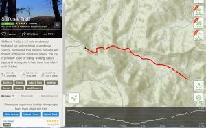
Big Stack, SlickRock and the Stiffknee Journey
AJ and John Dempsey are friends of ours and we rarely miss an opportunity to commune with them in the wilderness.
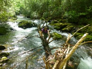
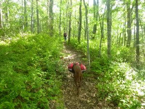
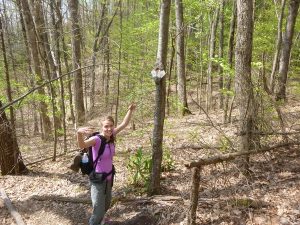
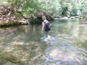
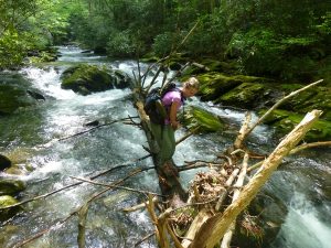
There were miles for me to capture in this area and high water or not, we did them. Laurel negotiates one of about 20 serious crossings on Slickrock.
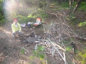
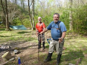 AJ and John were set up at Crowder Branch with a complement of wood and good company. AJ even brought me a generous birthday present that was shared around a roaring fire.
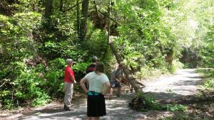
But first they had to clear the road up to Farr Gap. It is a wilderness and fortunately, someone had a chainsaw. That is one road where you probably need to carry one.
 AJ pointed out a huge prize in our campsite. I will add that we usually camp at the Crowder Horse camp in the shadow of Hangover. But they had set up down here and we almost didn’t find them in the fading daylight of a friday evening. It was a better choice for two reasons. One was the abundance of firewood and the second is a spring with some extremely sweet tasting water. We caught up with each other and bedded down for what was going to be a big day for me and Laurel. Here is a map of our loop.
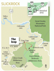
It is a 12 mile loop and begins at Farr Gap. We dropped from Crowder Branch down to Slickrock Creek. It was hot, snaky and full of bugs and ticks.
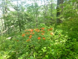
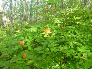
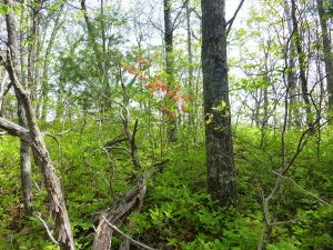
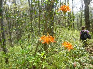 This is Big Stack Gap. It drops about 1200 feet down to Slickrock Creek. Every stop promised to uncover a timber rattler much like the one John and AJ almost stepped on hiking in on Friday. Fortunately, we saw none of those, but we also didn’t see our feet. The flame azaleas were amazing.
 Bear Reserve
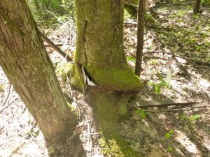 Know what that is? Let me zoom in for you.
 Yeah, its a bed frame and the tree has grown through it.
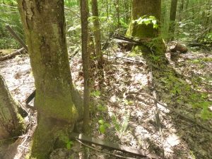
 Big sawbriers and weeds.
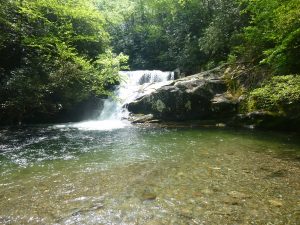
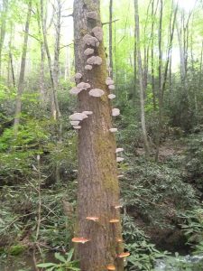
Wildcat Falls is iconic. Given that we were steamy hot from two hours of hiking, a swim was in order.
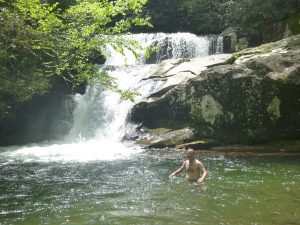 Man, was it refreshing. I was so taken with the bath, I almost didn’t notice this guy.
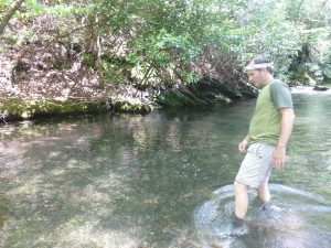
Little did we realize the amount of work that lay ahead. About 20 serious crossings of Slickrock creek ensued. A weekend of record rains had set the tone for this epic.
 Looks like even the hornets wanted near the cool water. We were soaked the entire time and I took an epic fall.
 This was one of the easy ones. With record rains came record crossings. There was a reason we saw no one at all on this trail.
 This was more representative of our trials by this trail.
 Rocky Ledge would know this one. I’m looking forward to being with the Muir Guys next weekend.
When we made our last crossing of Slickrock and began the Stiffknee, I was prepared. Stiffknee is 1600 feet of climbing in 3.2 miles. And aptly named.
 Stiffknee can best be described as a second growth scrub forest with some incredible uphill pulls. It came by the name honestly. By now we were running out of steam. Slickrock had kicked our butts and we still had 7 miles back to camp at Crowder Branch. We climbed, and we climbed and we climbed. Laurel reached a wall about the time she encountered a bigfoot. Or a rock thrown that sounded like one. That resulted in her stepping in a suck muck and totally muddying her shoes. She wasn’t amused.
What you are looking at is 1800 acres of wilderness that I hope will be added to Citico. It has been held up in legislative hell for many years and since I was heading that way, decided to do a little investigating. I found out that the TN Wilderness Act was approved but never enacted. Apparently there was some problem with Congressman Fleischmann down Chattanooga way. A lot of these guys don’t like taking land off the table when there is a dime to be made by milking the crap out of it. I contacted Will Skelton, because I knew he would have the scoop. As expected, he confirmed that Fleischmann was holding things up. I told Will I would pass along the word so any of you folks down in Chatty or in his district should contact him to let your thoughts be known. This stretch of Wilderness is an important corridor between Slickrock and the Smokies. I would hate to see it developed, as I’m sure some politicians would.
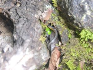
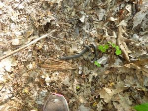 Left turn Laurel was playing with the dying ring necked snake when I approached. Judging by the wound, it had been bitten by a rattler. I advised her to drop the snake and move on because the rattler was probably nearby waiting for it to die.
 More flame azalea action was found along the Fodderstack Trail as we drug ourselves the final three miles back into camp. AJ and John did the Mill branch loop for their daytime outing. Our total time on the trail was 8 hours, six of which was hiking if you discount the swim time and a break at Farr Gap.
 We exchanged tales of our respective journeys into the Wilderness. If there is one good thing about the Smokies fee, it is that I have been driven to Slickrock/Citico. Slickrock/Citico is wilderness and I am thankful for the efforts of those who made it such. Let’s help them add that portion to it.
 We coffeed up Sunday morning. I was sore from my fall on Slickrock. We got out of camp for the three miles back to Farr gap where my intention was to fish down the creek.
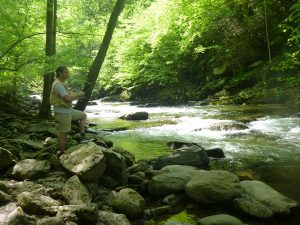 And fish I did. Citico hasn’t failed my in the last two outings.
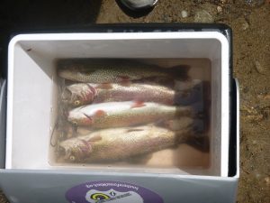 I call that dinner for two nights. And also a perfect ending to a wonderful weekend. Yes, there were snakes, ticks (I pulled about four off), bugs and heat. However, the offset was new miles, great company, good fishing, and a 20 mile hiking weekend. If that isn’t success, then I don’t know what is.
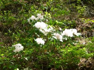
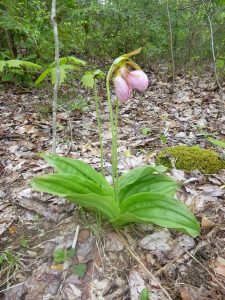
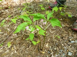
Mtn. Laurel was in full bloom.
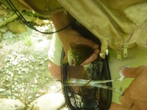 Fish ON!
Dancing with the Turquoise Goddess-Cho Oyu
Cho Oyu Recap April-May 2016
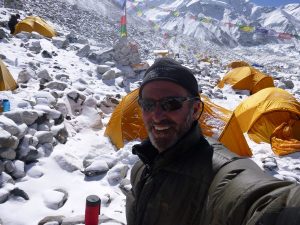
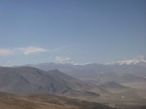
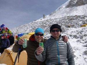
It’s hard to imagine presently that one year ago I was shivering nightly in a minus 40 degree sleeping bag trying to figure out how to thaw a seemingly permanently frozen big toe. It was Andrea’s idea. At least that’s what I told people. It was his big idea to go all in on Cho. He had failed on the peak two years earlier and the itch to finish this project was gnawing. Of course, it took little for me to abandon my practice, take a leave of absence and deplete my savings for a grand adventure of this magnitude. I had a room with a view, an incredible panorama of the Himalaya jutting through my sliver of real estate in Tibet and cascading across the Nangpa la into Nepal’s portion of the greatest range on earth. That was worth 14 grand, right?
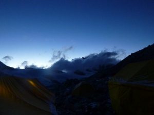
Mornings began with a breakfast bell as the sun crested Nangpa peak in the shadow of the Turquoise Goddess, Cho Oyu. Clouds wafted below us in this springtime elevation of 18,500 feet. Winter maintained her full grip on these chalky islands of rock and snow as evenings succumbed to daily storms that drove grizzled climbers deeper into down.
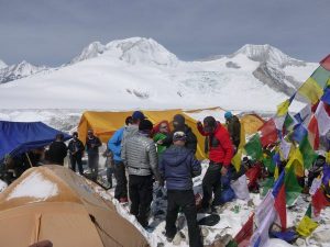
It had taken our team two weeks to arrive at what ended up being camp 3 or base camp on Cho Oyu. From our origin in Kathmandu, Nepal the journey would involve an attempted flight to Lhasa Tibet that was diverted to Chengdu, China for suspicious “weather related” reasons. That overnight stay deprived our assemblage of dinner, or any reasonable semblance thereof as we were whisked to accommodations for a brief rest prior to a second attempt on Lhasa. Four am dawned loudly as we re boarded an Air China flight and successfully touched down in the thin air of 12,000 feet on the high desert plain of the once forbidden city. The Chinese ran the Dali Llama out of his country when they invaded in 1952. Lhasa is the spiritual home of Buddhism’s spiritual leader who has remained in exile for decades. We circled the beautiful Potala Palace and breathed the dusty, thin air of higher altitude. It would require a few days of puffing before we could board buses that would ferry our group of nine mountain climbers across stark landscapes through towns called Shigatse and Tingri which required overnight stays.
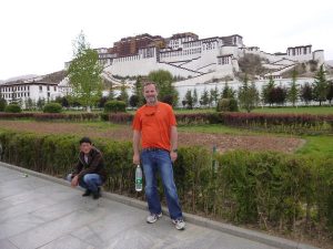 Potala Palace in Lhasa.
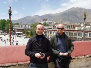 My cohorts, Andrea and Freddie in Lhasa
Tingri was a stark place. The Clanton brothers could have faced Wyatt Earp here except that would probably require oxygen and their bullets would be better spent on feral dogs.
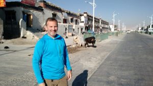 Tingri, with cows and canines.
 Everest from a hill overlooking Tingri
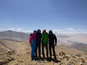 Katya (A North Col Everest client from the Ukraine, Andrea, Me and Freddie on our acclimitization hike outside Tingri)
Canines ran this place and we were cautioned to avoid the dusty street at night. Packs of animals were known to take small children. The nights I spent there were shared with a hound from hell parked outside my window. His incessant howling was a warning. We did an acclimitization hike to gain a view of Everest shown above. Gladly we departed his city. Our last bus ride was to Chinese base camp at 14 thousand feet.
We
spent two wind whipped days here in the shadow of a military compound hiking the nearby hills for some elevation gain before embarking upon a fourteen mile walk to true advanced base camp That trip was broken by an intermediate camp wherein we were stuck for an extra day due to a snowstorm that halted our supply chain of stinking yaks and stinking yak herders. Men of dubious decree, these Tibetans burned dung in canvas tents with a smell that will never be fully dislodged from my nostrils. At the time I thought it preferable to freeze than live with such wafting filth. Soon my attitude about it would change.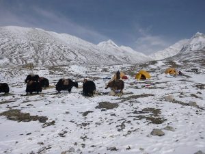 Intermediate camp bet BC and ABC.
When we began our final approach to ABC, it was a seven mile day and two thousand foot gain that saw me sauntering into base camp next to last. I was ahead of Khai Ngyuen who was similarly ambling. There was little point in racing and depleting valuable energy stores this early in the ascent. I watched Freddy Johannsen and Andrea make it in record time along with several other team members as I pulled up the rear, barely ahead of the yak. The Himalaya was breath taking on multiple levels and I wished to enjoy the walk. Our expedition leader, Dani Fuller came back to check on us and was relieved to see that we were fine, just dawdling along the snow covered boulders in the last few meters before the glacier.
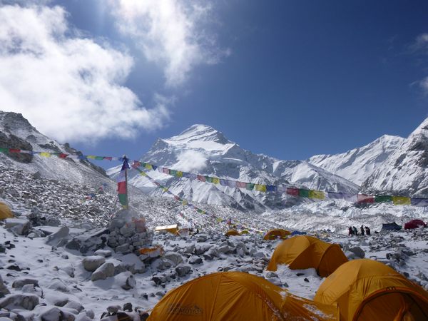
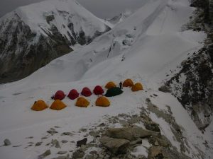
 first view of base camp, 18 thousand feet.
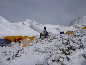
Our Summit Climb group joined a community of varying colored tents of different expeditions. There was the Jagged Globe team, a higher end British outfit that offered meals with lamb and more expensive snacks were available daily. They also had a doctor and access to weather reports that were “borrowed” by us at different times. Prior to this journey, I was convinced of the need to sign on for full services. Full service meant bottled oxygen and Sherpa support. I intended to employ oxygen for the primary reason that my previously frostbitten appendages were at risk without. It is well known that breathing “gas” improves blood flow to extremities. This weather seemed to reinforce my decision, however expensive. The addition of oxygen added $2100 dollars to my already depleted trip expenses. With Sherpa support and the derailment to Lhasa compliments of the Chinese, my investment topped 14 grand for this “grand” adventure into Tibet. Regardless, the idea of not carrying my own tent, food and stove would free me for the primary focus, climbing.
 Puja ceremony
Several odd things occurred as we settled into camp and initiated our puja ceremony. A puja is a religious observation wherein objects are offered to the mountain gods and Buddhist prayers are recited over rock cairns. Climbing gear is blessed by the llama, which in our case happened to be the kitchen servant. Over the course of an hour on our second day he read from a book and threw flour into the air as our group placed crampons, ice axes, boots and all manner of gear for blessing. Soon beers were produced and the observance took on a party character.
I watched from a distance having decided well beforehand that worshiping mountain “gods” and laying equipment before them was contrary to my personal belief system. I was fairly confident that to do so would be violating one of the most important of commandments and I wished to mitigate my history by following my conscience for once. It was duly noted amongst my team members, one of whom suggested it may be “disrespectful” to the locals. I politely explained that worshiping other deities was quite “disrespectful” to my God but didn’t begrudge them for complying with the custom. I approached the Sherpa sirdar, Thile Nuru, and told him that I wished no disrespect and he seemed to understand. The ceremony ended with faces full of flour and all participants drinking beer hauled specifically for that occasion.
Immediately following the puja, David Roeske and his personal Sherpa,- — took off for the summit. If that sounds strange, it should. David was an Everest summiter from the North two years prior. At 27 years old, Roeske was a New York investment banker. His goal was to polish off Cho Oyu without oxygen and move right over to Everest and do the same. He was undoubtedly one of the fittest of our team and when he disappeared with his Sherpa on the first walk up the glacier, I had little doubts he would succeed. (David eventually summited in record time then moved over to summit the North Side of Everest without oxygen, an incredible feat by any standard) One day later, we followed in his footsteps and ascended into the clouds and snow of camp one at 21000 feet. Passing Freddie and Andrea, they recounted the horrors of the terrible scree hill. I wasn’t particularly struggling yet but this was soon to change.
 Camp 1.
The horrible hill is legendary on Cho Oyu. It is almost two thousand feet of movable gravel that often gives way forcing you to sacrifice your minuscule gains. Two to three steps would gain you a half foot of elevation, if you were lucky. I remember climbing for hours only to find another scree hill and no sight of camp 1. It was demoralizing. The weather turned bad halfway through the scree and our Sherpa, and young boy named Lhakpa, was already struggling with altitude. This was apparently his first expedition and he wasn’t doing well. When we arrived in camp 1, I picked an established tent and began settling in. Not many folks were there but our leader, Dani Fuller was somewhere between here and camp 2 chasing David. I had barely crawled into the tent when radio chatter indicated Dani was descending and not doing well. Soon, from the winds and overcast snow clouds, I heard Dani come “falling” into camp. He was having difficulty and needed assistance. He was also unhappy that the Sherpa had failed to come to his aid. There ensued a discussion about his radio pleading that went unanswered. We put Dani into a tent and took oxygen saturations. He had apparently scared himself with what occurred up there. He was very agitated and we had to force him into a tent and make some tea. The night was consumed with making sure he wasn’t suffering from edema, pulmonary or otherwise. It was a minimally restful evening, as are most at these heights.
The morning sun didn’t crest until about 9.30 and we began the task of melting snow and dumping loads for our descent back to ABC. Dani had survived the night at camp 1, which is more than I can say for one of our “neighbors”. As I scanned the horizon an unusual blip appeared on my radar about 50 yards from our camp. There was a mysterious pyramid of nylon that gave appearance of an old, small tent, straddling a small crevasse. This pyramid turned out to be what remained of a climber who perished her several years ago. This climber had succumbed to altitude and was left in this position, covered by the remains of a tent. It was a morbid and visceral reminder of the game we play at these heights. My water froze during the night as did I. I left the big down bag at ABC, not thinking it necessary. Instead I slept in my down suit and crawled into the 20 degree bag. That was a tactic may summit folks use on their final push. It wasn’t going to be a tactic for my summit push as I shivered uncontrollably and awakened with no drinking water. Mountaineering 101. Always sleep with your water. I put the water into a neoprene sleeve which has never failed me. It failed for certain this time.
We walked Dani back down the horrible scree hill to base camp. He had decided to avail himself of bottled oxygen given his struggling and we aided him down to the glacier. As we got within an hour of ABC, the radio announced that we would be encountering two new clients in the form of Norris Merrit and John Nigh. Norris and John had just come off an attempt to gain the North Col on Everest and were acclimatized to meet us for a full attempt on Cho Oyu. I remember meeting Norris on the glacier and watching him speak with Dani, who was breathing bottled oxygen. The scene was rather bizarre as Norris was outlining his needs with regard to a personal Sherpa and additional oxygen. Dani spoke in between breaths of his regulator.
Many days later, Dani confronted the other Lhakpa Sherpa This Lhakpa (Lhakpa is as common a Sherpa name as Jim or Joe) The inference here was that Lhakpa was more focused on his client, David, than Dani who was having problems above camp 1. The exchange between Dani and Lhakpa was quite heated and made for an uncomfortable experience in the base camp dining tent. There was a point in which I was brought into the argument, having witnessed Dani’s portion therein. I tried to remain as neutral as possible but later events would cause me to understand the nature of Dani’s anger. I did confirm that I heard Dani on the radio from camp 1. Lhakpa’s response was, “This expedition is over for me, I have nothing else to say.”
The remaining days consisted of acclimatization runs up to camp 1 and climbing between one and 2. I am not going to go into details, they are the . But here are the highlights: The weather remained cold and snowy in the afternoons. I stayed cold all night, most nights, at base camp Khai and I got lost once getting to the scree hill and that caused a bit of re navigating since we were alone. On our turns into camp 1, there was no Sherpa and no food to be found. We had to scavenge into Sherpa tents to find ramen noodles, things for which we had paid a premium price. The “full service option” added about five thousand dollars to my total once you figure in the oxygen costs. Presently, I wasn’t seeing any benefit for my expenditure.
One significant thing to note here is that our group got split into two teams. There was a first team then my team which consisted of myself, Khai, Norris, John and Chris, the Australian. Chris had trouble when he spent the first night at camp 2 and required oxygen for sleeping and assistance on descent. I passed him coming down and he was knackered. This may have been a personal altitude record for Chris and these are not unusual circumstances. The decision to split the group didn’t bother me. I always prefer the rear as the first team was comprised of rabbits I didn’t wish to chase. Being at the back always allowed me to pace myself. Like Ed Viesturs told me in Kathmandu, “Take it slow”. And I did. That proved to be my undoing on this peak. (I met Ed at a cafe in Thamel, he was there to trek in and around the Everest region with his son, Gil)
 Me and the legend, Ed Viesturs in Thamel, Kathmandu.
Fast forward to May 16th. Chris Wilcox and I were in camp 1 for the third time. Team one had successfully gained the summit of Cho Oyu and from our vantage point in perfect weather at ABC, I followed tiny dots through my binoculars as they crested the long summit plateau of Earth’s sixth highest peak. They could not have created better weather and I saw my team mates, Andrea and Freddie take their final steps miles above me as I waited anxiously in ABC for their return. It seemed as if Dani, our leader, had lost his will to climb after the altitude issues from the beginning. His lassitude was palpable and our team independently decided to move up to camp 1 and begin our assault before the weather closed. We had no Sherpa in camp until later in the morning on May 17. Chris and I decided to move up. Khai and Norris and John lounged about camp much later than my comfort level. Chris and I began the crux through the ice cliffs. The ascent here was most dramatic as there were many pitches of moderately technical ice with fixed ropes. I had never ascended ice like this on a fixed rope.
Ten hours from camp 1 found me in camp 2 with horrible wind and cold. My ascent was epic and the many pitches of near vertical ice were draining. I switched from fixed rope to fixed rope hoping to have made the right choice as many flailed in the increasing wind. I was gaining great altitude and hit a short plateau whereupon I hoped to find some tents. I did not and was instead tasked with another hour walk across a crevasse strewn plain at 23000 feet. I finally spied some nylon and hurried to disappear into one of the sanctuaries for some rest before my summit push in a few hours. It was cold, brutally cold and stark.
I yelled to see if anyone occupied this ghost town of a tent city. The omnipresent and increasing wind muffled my voice. I hear a faint response and it was from Dennis Mildenberger. I hadn’t seen Dennis for days, he apparently got sick and couldn’t join the first wave in their summit assault. Dennis had been waiting for two days up there, sipping oxygen in anticipation of our arrival and the Sherpa to escort us. Little did we know that was not to be.
I collapsed in the first available tent which happened to belong to Jagged Globe. They had abandoned it on the hill as their team forfeited their summit collectively. It was to be my home for three days in a gale unprecedented at 23,500 feet high on earth’s sixth highest peak. As I crawled into this red domicile, my body melted into a puddle atop my down bag. It was difficult to move and hydration was critical. The wind picked up as daylight ceded to Himalayan night. Soon, Chris was crawling into camp. Much later in the night, Norris was heard yelling outside of camp. He was breathing oxygen now and needed assistance. Dennis was in position to assist him into his tent. I crawled out and inflated an air mat. Norris was preparing to collapse on the snow outside of Dennis’ vestibule It would have been a near fatal mistake. We forced him to crawl inside and lay on the mat. He resisted us at first but soon acquiesced. The cold gripped my fingers and reminded of the frostbite from 2011 on Muztagh Ata. I couldn’t step out without mittens for any reason.
Now with Norris taken care of we waited on John and Khai but Norris intimated they would not be making it up. He conveyed that Khai had difficulty with the technical section and turned around. Later he muttered something about John losing a glove and being helped back by Sherpa. Either way, it was becoming apparent we would not go for the summit tonight. I layed down and began melting more water. Most folks would sleep on oxygen here but none was to be found. Sherpa were to haul it up and they were apparently in absentia. I would have to tough it out in the increasing gale that saw my tent begin to collapse in. We couldn’t hear each others voices in shouts across camp. But there was little need to convey what was happening. Hunkering down was our only option until the storm passed. Provided it did.
Day two found me holding the side of my tent from collapsing in on me. Here is a video clip.
The good weather that blessed our forbears had taken a crap on us. This was one of the bigger wind events that I have experienced in the mountains. Day two was an exercise in existence. I melted water, alone in my tent. Dennis and Norris and Chris were similarly left to their own devices. I left the tent but two times per day for obvious reasons. It was brutally cold and my fingers felt the pain whenever I removed a mitten. At some point Thile Nuru arrived and occupied another tent. It was his first time to this altitude on this expedition. How he was going to lead us up was a serious question. We were breaking down every minute at these heights but the weather was showing signs of breaking. Another night was spent freezing.The next morning, Thile Nuru came around and checked on me. Through the heavy gale, I inquired about our summit plans. Thile looked at me incredulously. “You still want to climb?” He asked. Soon he was canvassing the other domiciles asking the same questions. In two hours, he returned to inform me that we were going down. There was no oxygen for our attempts and my team mates had, according to Thile, collectively decided to descend. The “missing” Sherpa had now arrived with the sole intention of breaking down camp. They had no oxygen in their possession. My disappointment was great and all I could recall was the 14 thousand reasons to climb on. I was a bit weak, but with oxygen, about which I had so dreamed and paid, could certainly make an 8 hour climb to the summit.
As I packed up for the long slog down, the temperature bottomed out as often occurs after a big storm. I was nearer to frostbite at this point than ever on the trip and all I was doing was putting on a harness. One of the Sherpa assisted me as I knew better than to remove my fingers from the down mittens. I choked down some breakfast and coffee and helped break down the tents. Cramming everything into my pack, I began the steep rappels through the ice cliffs with the summit of Cho Oyu looming over my right shoulder. The Turquoise Goddess was not to be my prize on this expedition.
We made it to camp 1 and overnighted in the shadow of the dead climber. I was dog tired after a long descent through windswept snow and fixed ropes. I suppose it took me seven hours to make that camp. With little to no energy from the nights at high altitude, I collapsed in my tent in the now beautiful weather of Tibet. This was my luck in the mountains so often. When we had all returned the following day to base camp, it was discovered that none of us had actually indicated a desire to descend. It was a ruse. Apparently the Sherpa had told the same story to each of us. Each denied having said they indicated any desire to abandon the summit bid. It was not painfully obvious that we had been manipulated by our Sherpa who simply didn’t have the resources to get us up the mountain. Had the oxygen been present, I would have pushed on regardless. In retrospect, I wish that had been the case.
We remained in base camp for three days as no yak were available to get us back down to true base camp. Our predecessors had abandoned our camp for the relative comfort of Tingri following their successful summits. It was me, Rasmus Kragh (who did summit and remained to support us), Khai Nguyen, John, Norris and Dennis. Dani was still managing things in our base camp. When an expedition is over, you are ready to leave in many ways. Having to sit for three nights after not reaching the summit was interminable. I tried to make the best of it by hiking around and climbing small hills by my tent. I did take my first shower in over five weeks by borrowing some water from the kitchen guys and bucket bathing. It was glorious. I had to force myself to absorb the beauty of this place and not focus on the disappointment of not summiting. When we were able to depart, we made good time in 14 miles one day down to Chinese Base camp. A car was there to meet us and make the final two hour drive into Tingri where we were reunited with our rested team.
We must have looked like we felt. I was sixteen pounds lighter, sun and wind burned and haggard as the yak-men. Sad news greeted us in that I learned one of our team members lost his mother back in Canada to Alzheimer’s while we were climbing. He and I had spoken of her condition on several occasions but she had deteriorated rapidly during our time in Tibet. We retraced our steps back through the high desert plains of Tibet through Shigatse and eventually to Lhasa where we overnighted and managed to catch a direct flight back to Kathmandu. While in Kathmandu we were visited with a small earthquake that is quite common for the area.
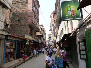 typical Kathmandu street scene of Thamel.
Many email exchanges were made with the leadership of Summit Climb. All of us were incredibly disappointed and angry over the turn of events at Camp 2. The resulting compromise on part of the outfitter was to offer us a 15% discount on another trip. It seemed cold comfort at the time. I’m not sure what lessons I gleaned from the Turquoise Goddess. Sometimes summits are not meant to be and I have experienced my share of peak denials throughout my climbing history. I will say that Tibet is a beautiful place and I was blessed to experience this portion of the Himalaya in all its late Spring splendor with a great group. I never fell ill, which is a first, I didn’t get injured, and returned with all my digits intact, despite having a cold toe that took a couple of weeks to rewarm. For me, that is a success and perhaps one day I will return to knock off the final portion of Cho Oyu. Presently, three of my team members on that expedition, Andrea Rigotti, Rasmus Kragh and Dennis Mildenburger are on another expedition to the summit of Everest. I wish them all Godspeed and good luck. You can follow them here at this link. http://www.arnoldcosterexpeditions.com/blog
If you enjoyed this trip tale, then you will really appreciate my first book, Tempting the Throne Room.

It was well reviewed in the climbing community and is available in many formats. I appreciate your visit to my site.
John
—-
SFW Helps Open Ijam’s Crag–Fantastic News!
Ijams to reopen climbing crag before watchdog group sues
Travis Dorman , USA TODAY NETWORK – Tennessee7:51 p.m. ET April 7, 2017
(Photo: Paul Efird)
More than six months after Ijams Nature Center closed Knoxville’s main outdoor climbing spot due to a lack of insurance, the park announced Friday it will reopen the crag by giving the land back to the city.
The nonprofit park previously had a contract with Knoxville for ownership of the land that required it to maintain “personal injury liability insurance covering the premises.” By ceding the crag, Ijams’ leadership can avoid finding a private insurer to cover unsupervised climbing, which proved difficult and time-consuming.
Beginning Saturday, climbers will once again be able to use the Ijams crag free of charge, provided they sign liability waivers. Ijams’ agreement with the city is temporary while the park works out a long-term solution, according to a news release.
Ijams closed the crag on Sept. 19 after a four-month-long search for liability insurance yielded only one option, which administrators were surprised to learn didn’t cover free climbing. After the closure, only supervised climbing and instruction classes were permitted on the crag, meaning climbers had to pay to play.
Members of Knoxville’s small but dedicated climbing community who worked thousands of hours to prepare the crag for public use — known as the Crag Committee or the Quarry Boys — were devastated by the unexpected development.
Eight days later, then-Executive Director Paul James stepped down to be replaced temporarily by former director Bo Townsend. Townsend filled the position for nearly five months until Ijams hired Amber Parker, who took the reins on Feb. 20.
Parker attributes those changes in leadership, in part, for the length of time it took to reopen the crag.
“But also because there was a lot of due diligence that had to happen,” she said in a phone interview Friday. “We had to work with the insurance companies; we had to look for other insurers that might be willing to cover that. … And really we could not find another private insurer that works with organizations like us that was willing to. So then we had to go back to the city and there had to be those negotiations and discussions, so it’s just taken a while.”
John Quillen, the board president of an an environmental watchdog group called Southern Forest Watch, suggested back in December that Ijams resolve the insurance issue by giving the land back to the city. The organization, which lost a 2013 lawsuit against the Great Smoky Mountains National Park over its implementation of back country fees, threatened in November “to take the next steps” if the crag was not reopened.
Once 2017 began, displeased with Ijams’ lack of progress on the issue, Quillen met with members of his organization, the Quarry Boys and a team of lawyers to form a “legal action plan” to force the park to reopening the crag.
Quillen was eager to charge ahead with a lawsuit based on the premise that by denying free access to the public, the park allegedly broke agreements with companies that donated money for the crag’s development.
But the Quarry Boys favored diplomacy rather than coercion, and met at least twice with Parker to discuss the issue.
“They weren’t wanting to burn any bridges with Ijams or the climbing community,” said Southern Forest Watch member Laurel Dunn, who called the Quarry Boys “really nice guys.”
Amber Parker (Photo: Courtesy of Chincoteague Bay)
The Quarry Boys came away “very impressed” with Parker, who member Micah McCrotty said “seems genuinely interested in the community.”
“We came away from that meeting thinking she actually wants to get this done,” he said. “And so John’s a great guy and he does great work, but we had full confidence that she would take care of it, and we knew it was going to be a matter of time.”
Quillen said Southern Forest Watch planned to send a letter to Ijams on Monday outlining the potential lawsuit.
Parker said she knew “absolutely nothing” of the threat of legal action, and said, “if that were in existence I would know about it.”
“We have really good relations with the climbing community,” she said. “I’ve met with the Crag Committee and they understood the constraints that we had. They’re already aware that the crag is open. They’re very excited, so, you know, relations are good.”
“This has been an ongoing process for quite a while and it just happened to culminate right about the time that i got here,” she added. “It’s been hard work on the part of Knoxville city and the previous leadership here to make that happen. I just happened to be able to come in and snatch a little glory at the end.
“I’m just really glad to be here for it. Certainly really all the credit goes to the folks that have worked so hard to make it happen.”
Citico
 (If you didn’t get to see the last post recapping our France excursion, scroll down for details)
The Mayor, aka my brother Todd, is back in TN for good. So first order of business was for us, upon my return from Europe and Todd settling into his new home on the lake was to reconnect with an area that has seen a good deal of trout slaying by the Quillen brothers. Here we stand at the infamous “double naught” campsite after a Saturday of full limit of rainbows.
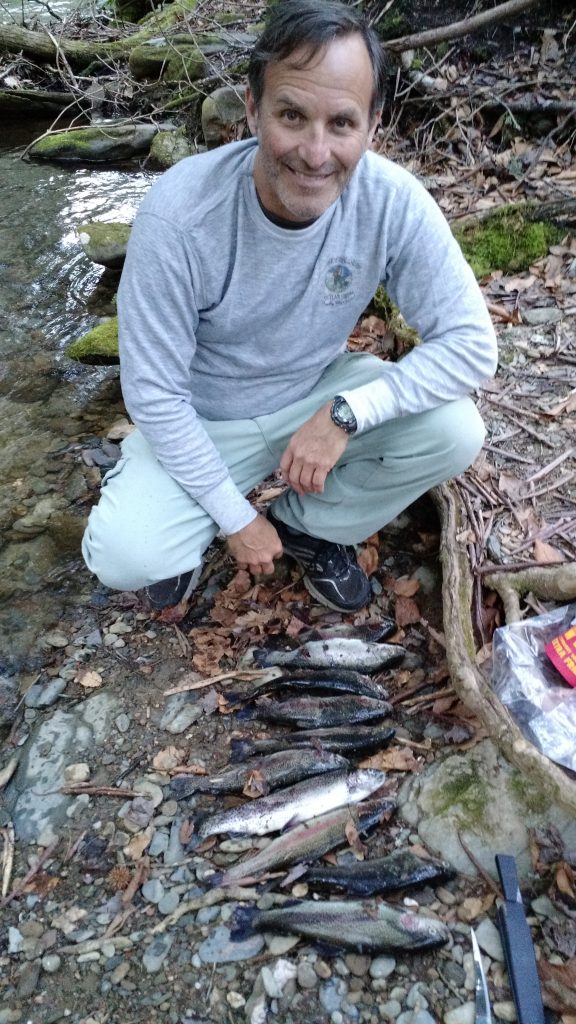
It was a perfect day and the fish karma was even better.
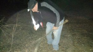 Bloody machete man got the fire roaring.
Sunday found us enjoying another perfect weather setting that was prime for round two of the trout bagging. It only took a couple of hours to limit out and we were steaming back to Ktown to eat these delicious offerings.
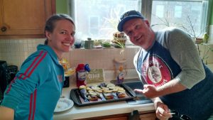 Laurel was ready with all the fixins and we cedar planked these suckers and grilled them to perfection. It was the perfect ending to a perfect weekend.
Paris, A Moveable Feast
Hemingway coined this phrase in the 1920s as he, along with other malcontents now regarded as the “lost generation” found their voices in the heart of the “city of lights”.
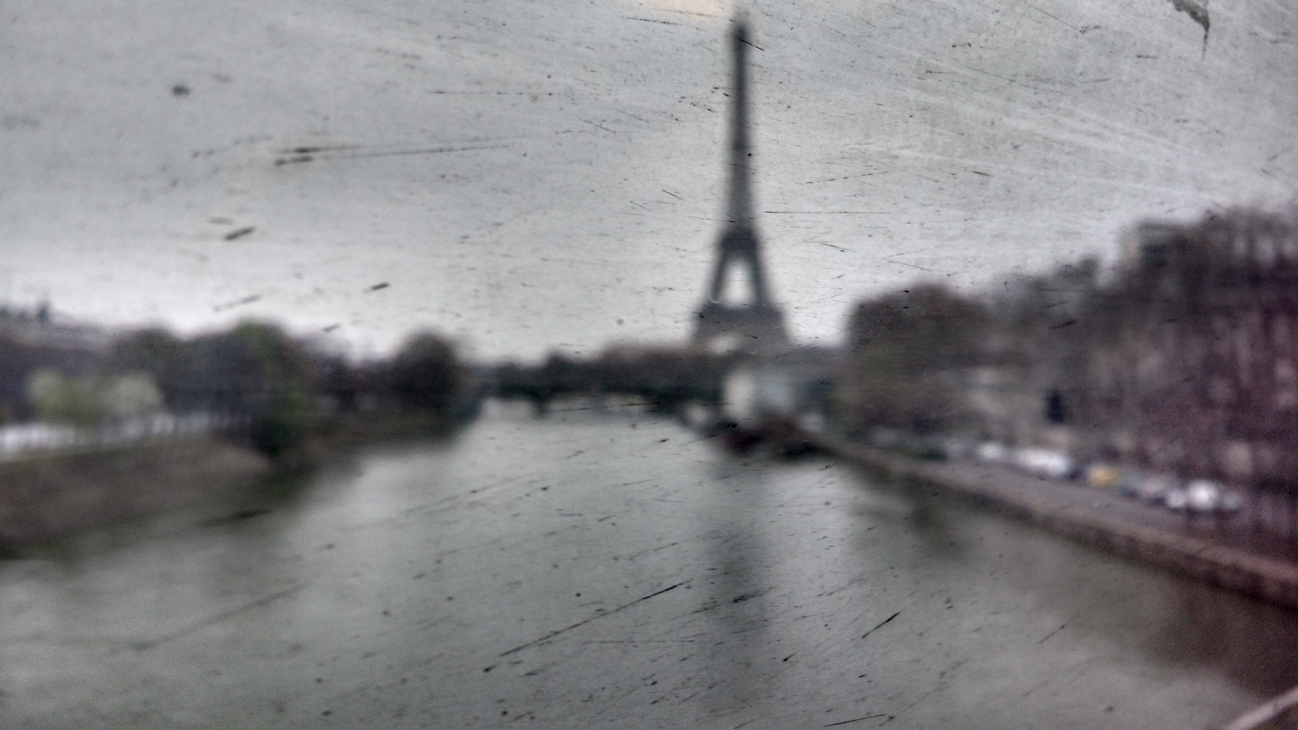
I took this photograph riding the RER train across the Seine. It is a dirty window on a cloudy day that gives this view of the “tour Eiffel” it’s dour appearance. I believe the impressionists would approve.
I’ve lost count of my visits to this place but each return just solidifies my love for what Paris represents. I get so tired of Americans who have never left the country denigrating the French because Fox news told them some BS. Yes, the French didn’t agree with the Iraq war and refused to follow Bush down that quaqmire. If anything, that gives them cred it my book. But even it todays toxic political climate at home, some of that misanthropy still exists. If the only place you get your information is Fox News, then you have more problems than can be addressed in a single therapy session. Every day, more and more, it is crystal clear that our President has colluded with an enemy of the US to subvert the political process and all Fox news can say is that the whole thing is just fabricated.
When the Iraq war hype was being fed to us via real “Fake News” I was lambasted for questioning Bush and the neocons. How dare you question our president in a time of war. Well, funny what a few years will bring, huh? It is now universally accepted that Bush and his whole team lied and now there is mounting evidence that they were more than a little involved in the events of 911 that got their oil hungry pals into the Middle East.
I am saying all this for one reason and some of you may not want to hear it, but I am going on record. Trump is an ignorant moron just like Bush. And ignorant morons are the most dangerous sort. Both Trump and Bush are owned by the millionaires who obviously pull their strings. So be very cognizant that Trump will likely follow the Bush playbook and start a false flag act of terrorism to deflect from his Russia scandal.
What does this mean? It means that Russia or some similar oligarghy will start something in a place like Syria, or pull a 911 type event that Bush so masterfully allowed to consolidate American support. It worked like a charm for the neocons on 911 and I am saying this to those who have sons and daughters that go die for these criminals. When the false flag event occurs, you better start questioning, reading other news sources outside of Fox and getting your affairs in order. Americans forget to wipe when they perceive some terrorist threat. We willingly abandoned all our freedoms for the Patriot Act and now, last week, the House signed a bill giving away all your internet privacy to the highest bidder.
I will end this lecture but take note, we are more vulnerable now in the US than at any point in my lifetime because we didn’t use our thinkers and fell for fascism. Americans falsely believed that a millionaire gave a flying crap about them. I can assure you he doesn’t care about anyone but himself and his other millionaire buddies. I know this because I deal with liars on a daily basis.
Now back to Paris,
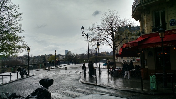
Our first day, after settling into our apartment, we walked the streets from the Bastille to the Eiffel Tower. It was five miles. Laurel and I cruised along the Seine, passing familiar sights such as the Louvre and Notre Dame.
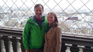
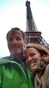 Then she made me climb that sucker for the millionth time.
Now that we had checked the box on tourist attractions, it was time to check off some other Paris sights. We secured reservations at some fancy dining establishements, one was in St. Germain de Pres and the fare did not disappoint. Our time on the Metro was extensive and Laurel can navigate that transit like a pro. I really enjoy the Paris metro, it is nothing more than an underground train and is very efficient. We rented an Airbnb and stayed in a traditional Parisian apartment in the 12 arrondisment in the old part of town. The metro was nearby as well as Gare Lyon, the train station. Benmoine was our host and her hospitality was appreciated. It was an old building with our flat being on etage 5, en Francais. My main objectives on this excursion were to make it to Versailles and go to Harry’s bar.
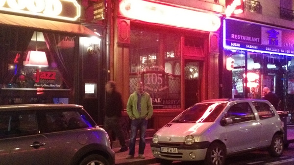
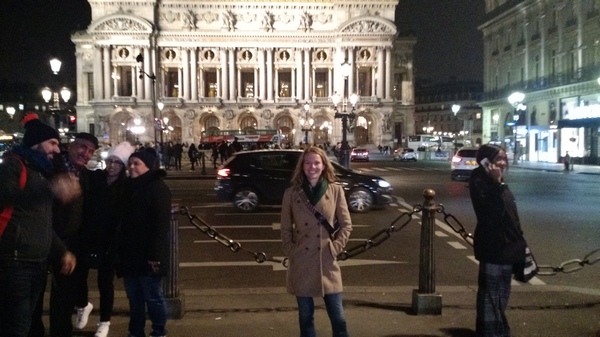
Harry’s New York bar was and remains a Paris institution from the time of Hemingway who hung out there. The bar invented the Bloody Mary drink, apparently. It is still quite popular with tourists. We metro rode to the Opera House in a rainy evening to enjoy that part of town. The metro pops us right up here. Are you starting to get a feel for the excitement of the city of lights?
Our time in Paris was three nights on the back end and the weather had been, well, French. Paris is always sort of windy and rainy so I delayed our pilgrimmage to Versailles until Saturday, which was a mistake. Although that was the perfect weather day, about 10 thousand others had the same idea. We boarded the RER train to Versailles and stood in a queu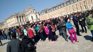 of no less than 4 thousand people.
It was a mistake, because our line was almost three hours long. Versailles had eluded me for approximately 12 trips to Paris. I can now allow it to elude me for 12 more.
This is just a thumbnail of our time in Paris. The nightmare returning and getting there is a story for another time. American Airlines has to be the most irresponsible carrier in the industry. I got what I paid for. A $510 ticket from Knox to Paris via Philly turned into an epic travel headache. But it still justified what turns out to be a 500$ minimum savings. This is how we felt after getting up at 4 am to get to the airport. Understand that while we were there, a terrorist opened fire at Orly airport and another similar act occurred in London. We had to return via both.
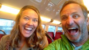 It’s enough to make you scream!
But overall a fantastic French experience, as usual.
Au revoir de la ville des lumières Jean!